
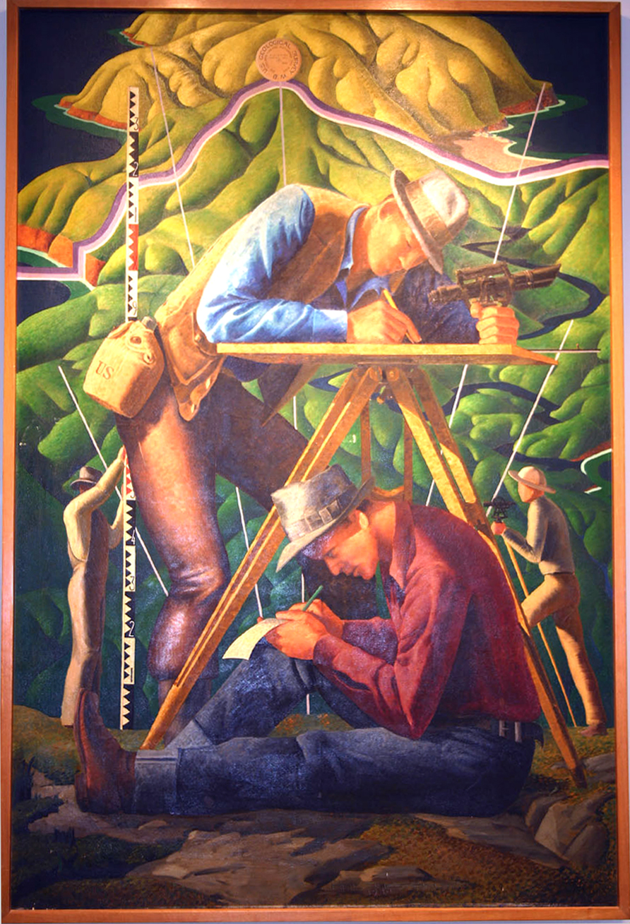
Cartographers in the Field

Detailed Description
This Depression-era oil painting was created by USGS field man Hal Shelton in 1940. The painting depicts mapping techniques used in the early days of cartography, including an alidade and stadia rod for determining distances and elevations and a plane-table for sketching contour lines. A USGS benchmark is visible near the top. The straight white lines represent survey transects. Note the "US" marking on the canteen: many of the USGS field supplies were obtained from Army surplus. This 4 ft. x 6 ft. painting is on display in the USGS library in Moffett Field, California.
Sources/Usage
Public Domain.