
Central Valley Hydrologic Model (CVHM)
By California Water Science Center
2009 (approx.)

Detailed Description
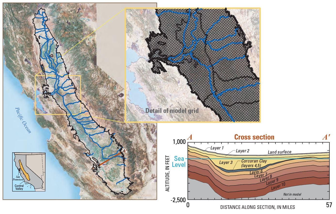
The Central Valley Hydrologic Model (CVHM) is built on knowledge from USGS and other Federal, State, and local studies. The CVHM was constrained by comparing simulated and historically observed groundwater levels, streamflows, and subsidence. The detail and breadth of this hydrologic modeling tool provides a better understanding of valleywide hydrologic processes. This tool also provides realistic boundary conditions so that finely gridded models of smaller areas can be easily developed. To create enough detail to be practical for watermanagement decisions, the aquifer was divided spatially into 20,000 model cells of 1 square mile each, and vertically into ten layers ranging in thickness from 50 to 750 feet.
Sources/Usage
Public Domain.