
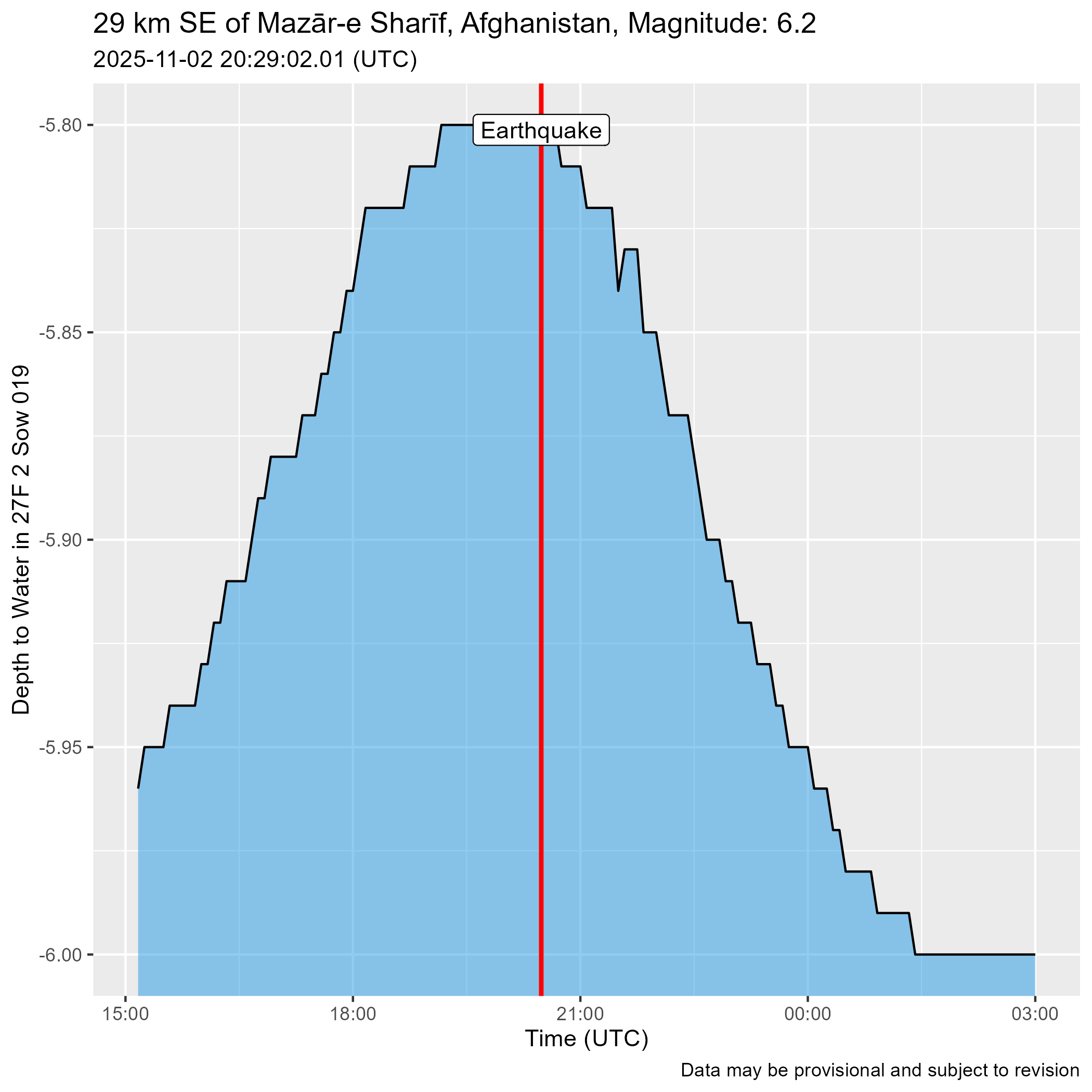
Christiansburg Well Hydrograph after Magnitude 6.2 Earthquake 29 km SE of Mazār-e Sharīf, Afghanistan

Detailed Description
Water level response in the Christiansburg Well to a magnitude 6.2 earthquake 29 km SE of Mazār-e Sharīf, Afghanistan
Sources/Usage
Public Domain.
Important: Data may be provisional
Data retrieved from USGS Earthquake Catalog using rcomcat and Water Data for the Nation using dataRetrieval