
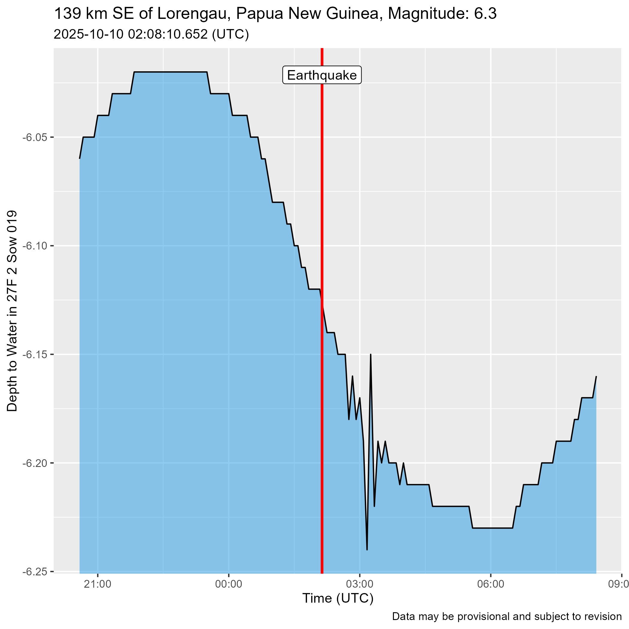
Christiansburg Well Hydrograph after Magnitude 6.3 Earthquake 139 km Southeast of Lorengau, Papua New Guinea

Detailed Description
Water level response in the Christiansburg Well to a magnitude 6.3 earthquake 139 km southeast of Lorengau, Papua New Guinea. This water level response is likely compounded by the effects of the magnitude 7.4 earthquake 12 km east of Santiago, Philippines which occurred 24 minutes earlier.
Sources/Usage
Public Domain.
Important: Data may be provisional
Data retrieved from USGS Earthquake Catalog using rcomcat and Water Data for the Nation using dataRetrieval