
Coastal Vulnerability for Channel Islands National Park

Detailed Description
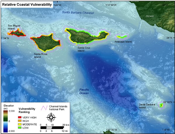
Relative Coastal Vulnerability for Channel Islands National Park. The colored shoreline represents the relative coastal vulnerability index (CVI) determined from the six variables. The very high vulnerability shoreline is located along sandy stretches of coast where regional coastal slope vulnerability is high and significant wave heights are highest. The low vulnerability shoreline is located along rock cliffs where coastal slope is steep and wave heights are low.
Sources/Usage
Public Domain.
Related

Coastal Vulnerability in National Park Units
These Open-File Reports are part of a joint effort by the U.S. Geological Survey and the National Park Service to map the coastal vulnerability of coastal park units.
Related
Coastal Vulnerability in National Park Units
These Open-File Reports are part of a joint effort by the U.S. Geological Survey and the National Park Service to map the coastal vulnerability of coastal park units.