
Comparing flood inundation maps during low and high flow conditions
Detailed Description
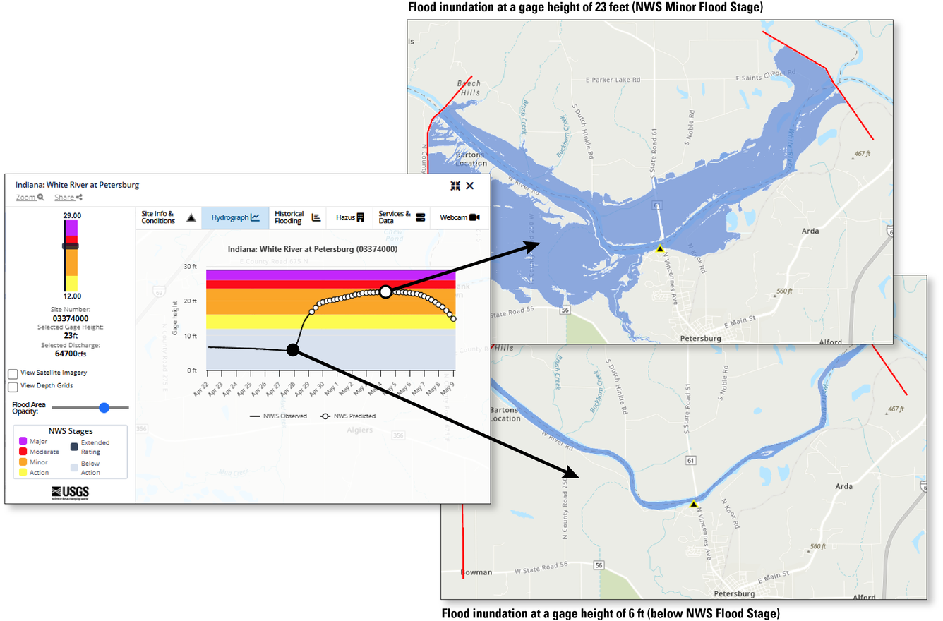
A flood inundation map (FIM) library is a set of maps that show the spatial extent and depth of flooding at specific water-level intervals along an individual stream section. Water level, or gage height, will quickly rise to a peak during a rainstorm and then gradually recede. This illustration shows the difference in inundated areas between two maps - one during normal flow conditions and one at the peak of a flood.
The U.S. Geological Survey works with the National Weather Service (NWS) to identify each stream's critical water levels where flood watches, warnings, and action should be initiated. The National Weather Service also combines their meteorological data with the USGS streamflow data to predict where flooding will occur and how extensive it will be.
Sources/Usage
Public Domain.
Related

Flood Inundation Mapping Science

Flood Inundation Mapping (FIM) Program
Related
Flood Inundation Mapping Science