
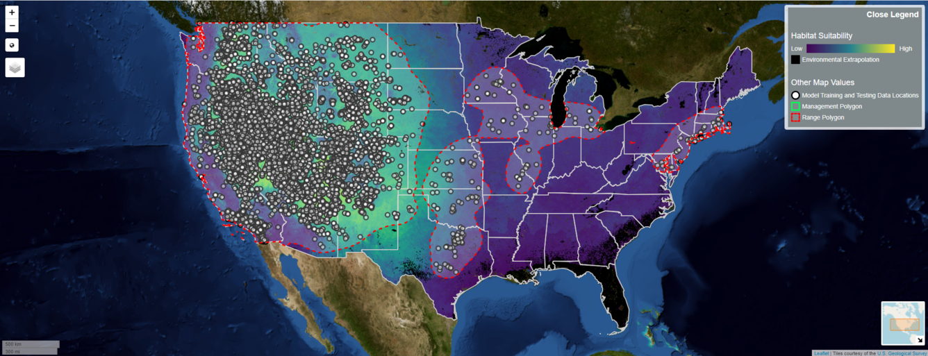
Continuous habitat suitability map for cheatgrass in the United States with data points and range polygon
By Fort Collins Science Center
December 2024 (approx.)
Detailed Description
A screenshot from the Invasive Species Habitat Tool (INHABIT) 4.0 displaying continuous habitat suitability for cheatgrass (Bromus tectorum) across the contiguous United States. Darker, purple color indicates low habitat suitability and lighter, yellower colors indicate higher habitat suitability, black indicates environmental extrapolation is limited. White dots represent locations of data used to estimate habitat suitability. The red line and faint white polygon represent the known range of cheatgrass within the United States.
Sources/Usage
Public Domain.
Related

INHABIT: A web tool for invasive plant management across the contiguous United States
INHABIT is a desktop-optimized web application and decision support tool with mapped and tabular summaries of habitat suitability models for over two hundred fifty terrestrial invasive plant species of management concern across the contiguous United States. It is the product of a scientist-practitioner partnership and is designed to facilitate enhanced invasive species management actions...
Related
INHABIT: A web tool for invasive plant management across the contiguous United States
INHABIT is a desktop-optimized web application and decision support tool with mapped and tabular summaries of habitat suitability models for over two hundred fifty terrestrial invasive plant species of management concern across the contiguous United States. It is the product of a scientist-practitioner partnership and is designed to facilitate enhanced invasive species management actions...