
Copper Map Plate Detail
Detailed Description
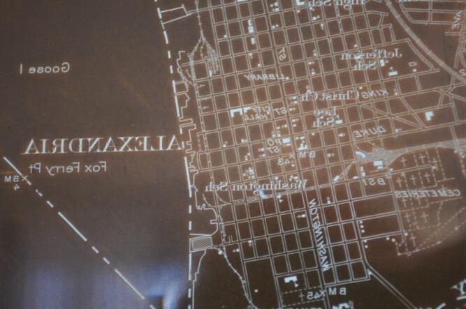
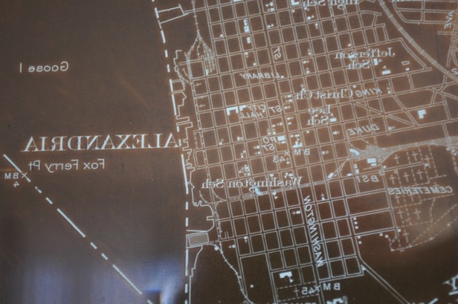
A portion of the engraving on the plate used to print points, lines, and text in black ink.
Engravings on the plate are left-to-right reversed. This plate was cleaned and treated to improve the visibility of the engraving. The plate was used to print the Washington [D.C.] and vicinity, 1:31,680-scale topographic map.
Sources/Usage
Public Domain.