
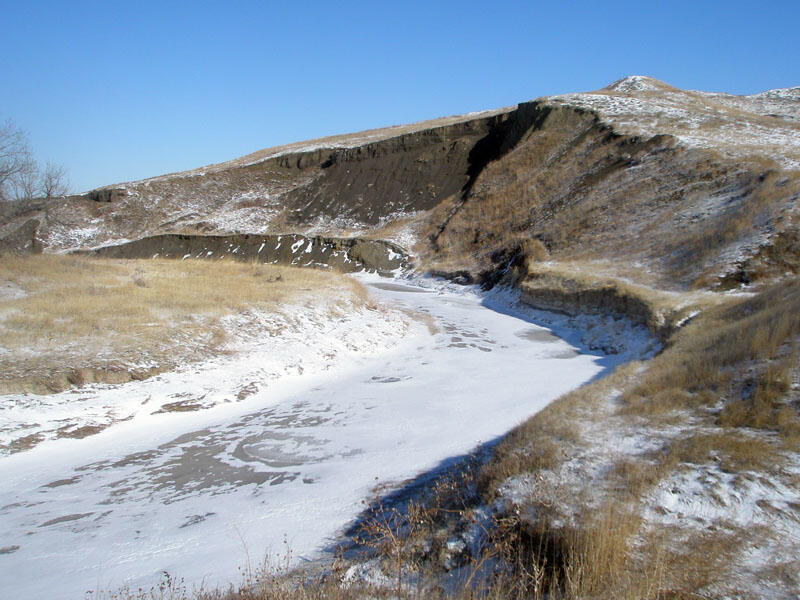
Cutbank in Sage Creek
Detailed Description
This cut bank (with landslide slump) is along a meander in Sage Creek near where the Sage Creek Rim Road crosses the stream (frozen). The dark, organic-rich gray shale formed from sediments deposited in the ancient Western Interior Seaway. During the Cretaceous Period, the Western Interior Seaway covered most of the region of what is the Great Plains today. It extended from the Arctic region, southward to the Gulf Region (NPS, 2008).
Sources/Usage
Public Domain.