
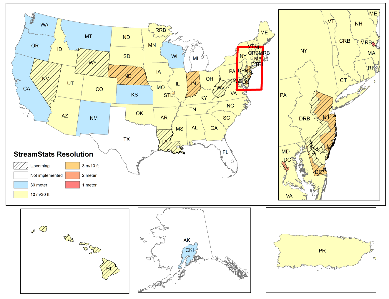
Map of states in StreamStats who have refreshed underlying elevation data
Detailed Description
Did you know the underlying data and functionality of StreamStats varies by state? StreamStats applications are developed by USGS Water Science Center scientists in cooperation with federal, state, and local agencies. The data, methods, and functionality varies from state to state based on availability of data, when the project was developed, and the funding available to develop the application. In recent years many cooperators have approached the USGS Water Science Centers with requests to refresh the digital elevation data and StreamStats delineation capability using lidar derived digital elevation models. South Carolina, North Carolina, and Pennsylvania have all completed refreshes of the underlying data. Delaware, New Jersey, and Indiana have refreshes in process.
Sources/Usage
Public Domain.