
December 22, 2025—Kīlauea summit eruption lava thickness through episode 38

Detailed Description
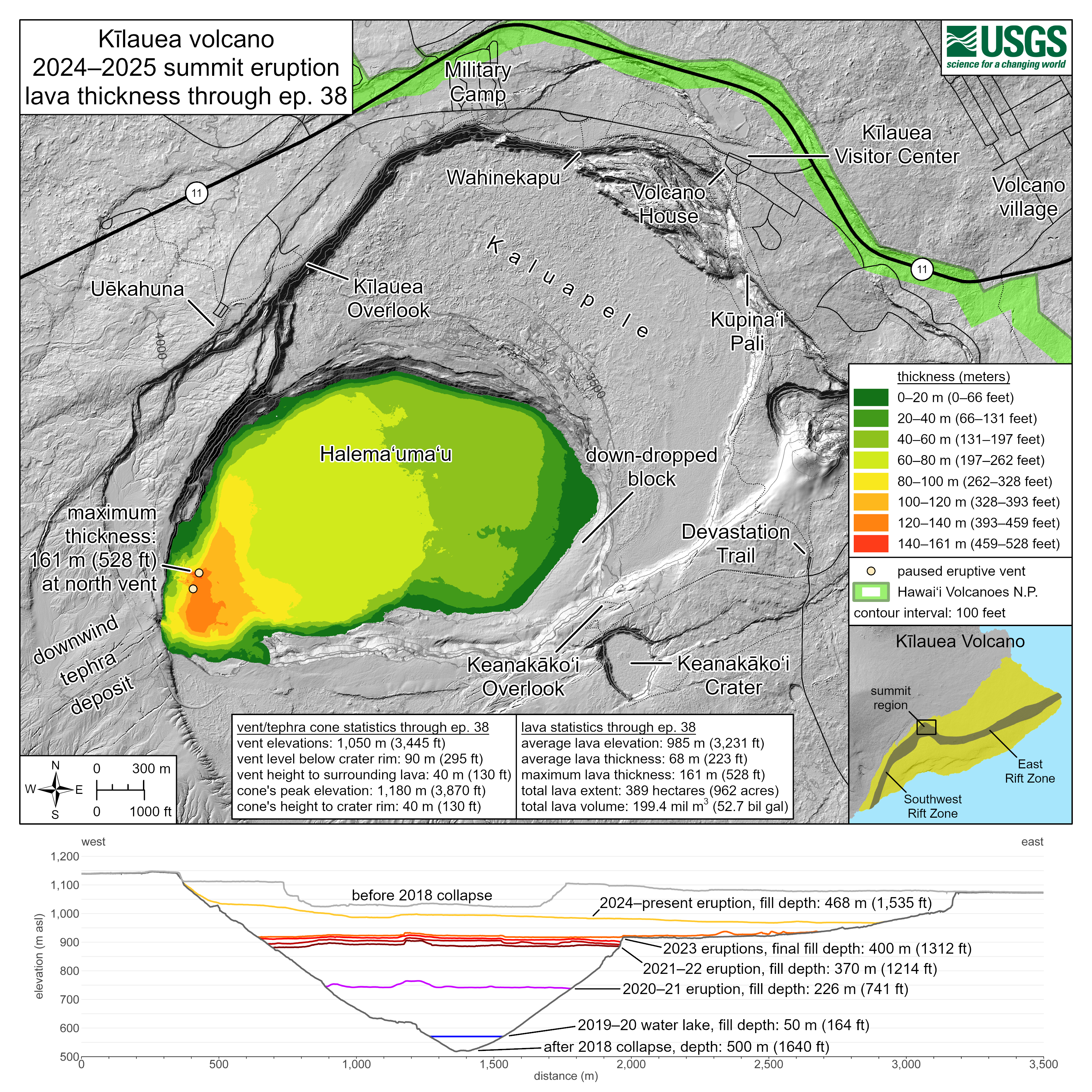
This map shows thickness values for lava flows within Halema‘uma‘u crater from the Kīlauea summit eruption that began on December 23, 2024. These values were calculated by topographic differencing between a digital elevation model collected on December 9, 2025—after eruptive episode 38—and one from before the eruption began. Also included here are west-to-east profiles across the summit caldera, depicting topographic changes since 2018. Profiles are provided for the periods before the 2018 caldera collapse, shortly after the 2018 collapse, following each of the five summit eruptions from 2020–2023, and for this eruption following the end of episode 38. Also shown is the maximum depth of the 2019–2020 Halema‘uma‘u water lake.
Eruptive vent and tephra cone statistics through episode 38:
- Vent elevations: 1,050 meters (3,445 feet)
- Vent level below crater rim: 90 meters (295 feet)
- Vent height to surrounding lava: 40 meters (130 feet)
- Cone's peak elevation: 1,180 meters (3,870 feet)
- Cone's height to crater rim: 40 meters (130 feet)
Lava statistics through episode 38:
- Average lava elevation: 985 meters (3,231 feet)
- Average lava thickness: 68 meters (223 feet)
- Maximum lava thickness: 161 meters (528 feet)
- Total lava extent: 389 hectares (962 acres) -
- Total lava volume: 199.4 million cubic meters (52.7 billion gallons)
Sources/Usage
Public Domain.