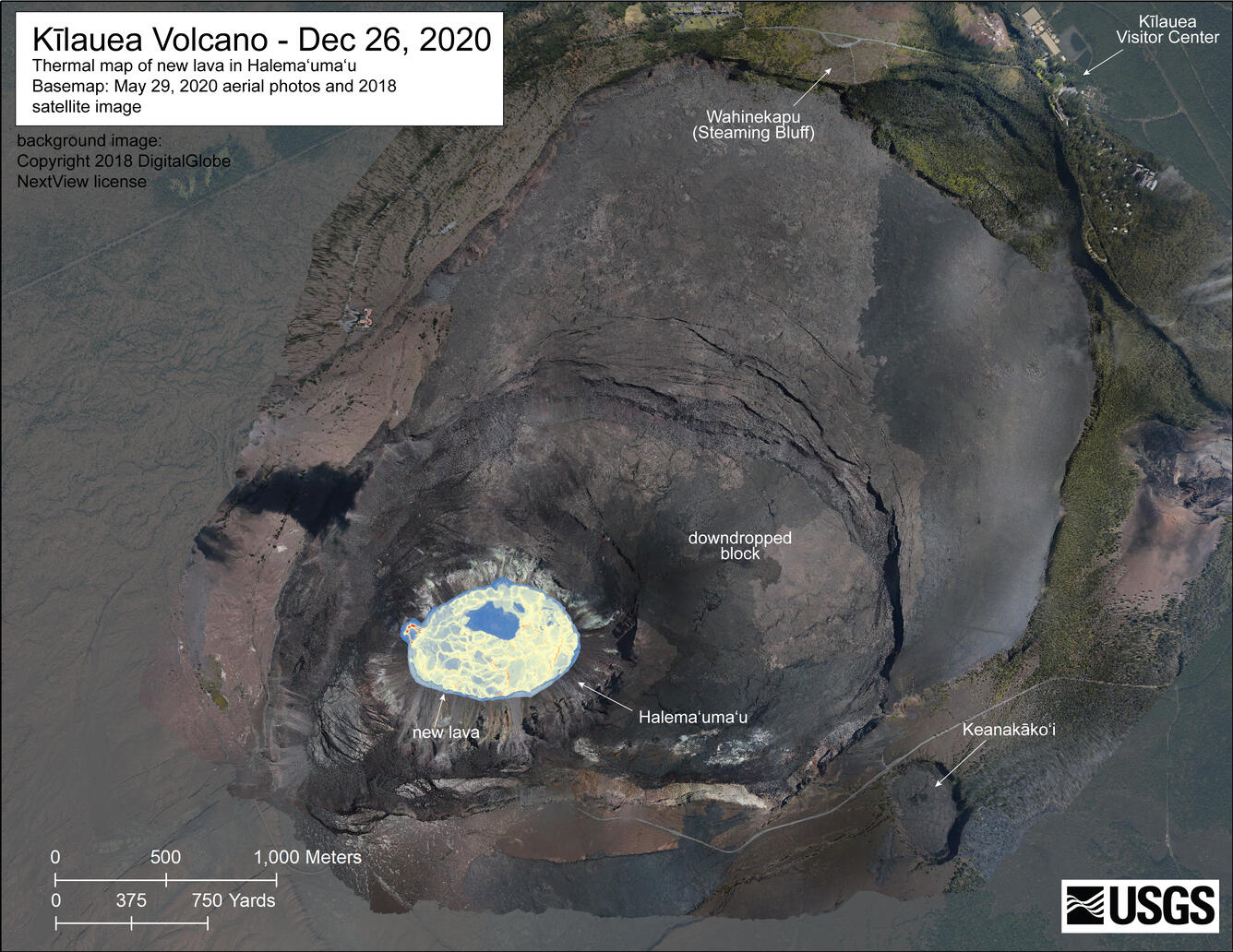
December 26, 2020—Kīlauea summit eruption thermal map

Detailed Description
A helicopter overflight yesterday (Dec. 26, 2020) at approximately 9:30 AM HST allowed for aerial visual and thermal imagery to be collected of the new eruption within Halema'uma'u crater at the summit of Kīlauea Volcano. This preliminary thermal map shows that the new lava lake is 790 m (864 yd) E-W axis and 520 m (569 yd) in N-S axis. The most recent estimate of lake area is about 29 hectares (72 acres). The scale of the thermal map ranges from blue to red, with blue colors indicative of cooler temperatures and red colors indicative of warmer temperatures. A new observation of the lava lake yesterday is visible in this thermal image as a blue ring at the intersection of the lava lake and surrounding crater wall, indicating cooler temperatures around the perimeter of the lake. The lake was surrounded by a narrow (extending out 10-30 m or 11-22 yd) ledge that is cooler than the rest of the lake. This suggests that the lake level had recently dropped slightly. The ledge was perhaps 1-2 m (1-2 yd) above the fluid lake level. USGS map by M. Patrick.
Sources/Usage
Public Domain.

