
December 27, 2020—Kīlauea summit eruption contour map
Detailed Description
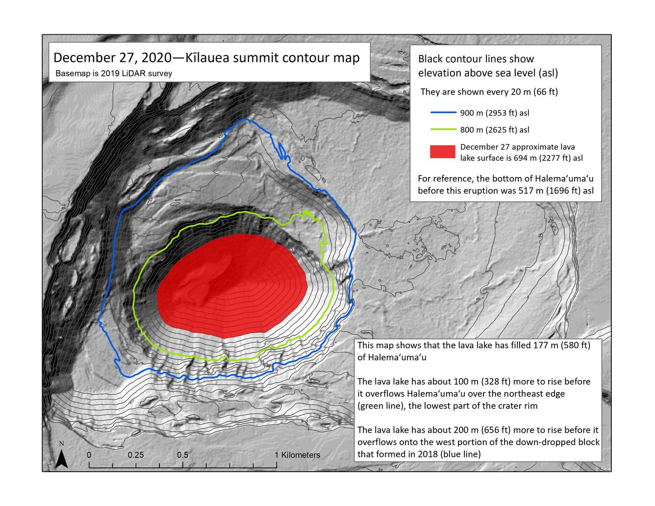
This map of Halema‘uma‘u at Kīlauea's summit shows 20 m (66 ft) contour lines (black) that mark locations of equal elevation above sea level (asl). The map shows that the lava lake (approximate outline marked in red) has filled 177 m (580 ft) of Halema‘uma‘u since the eruption began at approximately 9:30 p.m. HST on December 20, 2020 (nearly one week ago). The lava lake has about 100 m (328 ft) more to rise before it overflows Halema‘uma‘u crater rim on the lowest part at the northeast edge (green line). The lava lake has about 200 m (656 ft) more to rise before it overflows onto the west portion of the down-dropped block that formed in 2018 (blue line). For reference, the bottom of Halema‘uma‘u before this eruption was 517 m (1696 ft) asl. Initially, the lava lake was rising several tens of meters (yards) per day; however, the lava lake level has not risen significantly over the past day. USGS map.
Sources/Usage
Public Domain.