
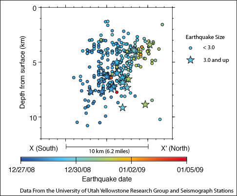
Depth versus location of the Yellowstone Lake earthquake swarm in a...
Detailed Description
Cross section from X to X' on Dec 12, 2008 to Jan 8, 2009 earthquake location map. Earthquakes are shown from Dec. 27, 2008 (blue) to Jan. 8, 2009 (red). The M 3.0 and greater earthquakes are shown as stars, the smaller earthquakes are shown as circles. Click on the image for a full-size version.
Sources/Usage
Public Domain.