



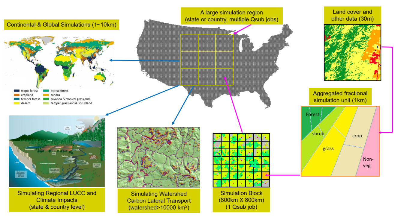
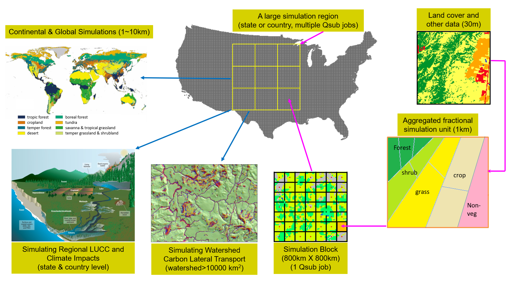
Diagram depicting the model upscaling framework used for the CONUS Ecosystem Modeling Project

Detailed Description
Conceptual diagram illustrating the model upscaling framework from fine spatial resolution to continental and global scales, incorporating fractional land‑cover aggregation and linkages to lateral soil‑erosion processes and carbon export to aquatic systems.
Sources/Usage
Public Domain.
Related
WGSC CONUS Ecosystem Modeling Project
Our planet is composed of hierarchical and interconnected ecosystems. The biogeochemical cycling of carbon, nitrogen, water, and other elements are fundamental ecosystem functions that support life. Natural and human‑driven factors—such as climate variability, wildfires, and land use and land cover change (LUCC)—can alter these cycles. Therefore, monitoring, analyzing, and predicting ecosystem...
Related
WGSC CONUS Ecosystem Modeling Project
Our planet is composed of hierarchical and interconnected ecosystems. The biogeochemical cycling of carbon, nitrogen, water, and other elements are fundamental ecosystem functions that support life. Natural and human‑driven factors—such as climate variability, wildfires, and land use and land cover change (LUCC)—can alter these cycles. Therefore, monitoring, analyzing, and predicting ecosystem...