



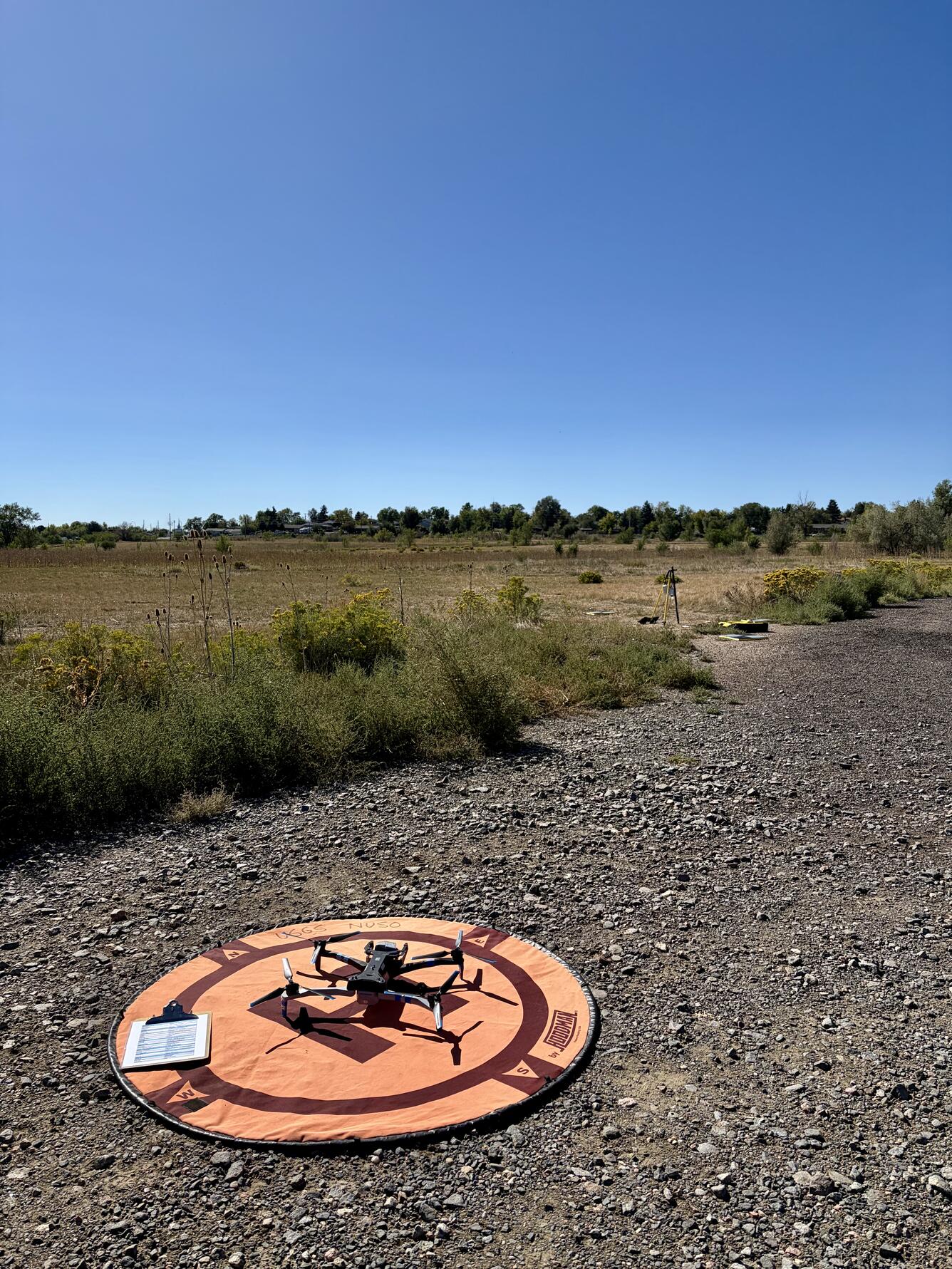
Drone on landing pad


Detailed Description
USGS scientists are using an uncrewed aircraft system (UAS) to range-test technology for tracking monarch butterfly migration pathways. A UAS, also known as a drone, carrying BluMorpho ultra-lightweight radio tracking devices or tags sits on a landing pad at the Denver Federal Center. The tripod in the background is supporting two “node” stations, which can receive location data from individual trackers. Of the 10 tags, six were placed on the uncrewed aircraft system (UAS, also known as a drone) and four were placed on the ground around the node station.
Sources/Usage
Public Domain.
Photo by USGS. Any use of trade, firm, or product names is for descriptive purposes only and does not imply endorsement by the U.S. Government.
Related

NUSO Research Missions
Research missions, often performed in cooperation with other DOI bureaus as well as non-DOI collaborators, serve as vital tools in the ongoing evaluation and integration activities that support the strategic implementation of UAS into the USGS and the DOI. * Any use of trade, firm, or product names is for descriptive purposes only and does not imply endorsement by the U.S. Government.

National Uncrewed Systems Office
The U.S. Geological Survey (USGS) National Uncrewed Systems Office (NUSO) leads the research activities needed to make Uncrewed Aircraft Systems (UAS) data collection an efficient, safe, and cost-effective remote sensing tool for Department of the Interior (DOI) and USGS scientists.
Related
NUSO Research Missions
Research missions, often performed in cooperation with other DOI bureaus as well as non-DOI collaborators, serve as vital tools in the ongoing evaluation and integration activities that support the strategic implementation of UAS into the USGS and the DOI. * Any use of trade, firm, or product names is for descriptive purposes only and does not imply endorsement by the U.S. Government.
National Uncrewed Systems Office
The U.S. Geological Survey (USGS) National Uncrewed Systems Office (NUSO) leads the research activities needed to make Uncrewed Aircraft Systems (UAS) data collection an efficient, safe, and cost-effective remote sensing tool for Department of the Interior (DOI) and USGS scientists.