
Earthquake Hypocenters Map and Cross Section - Past Week Kilauea
By Kīlauea
2019 (approx.)
Detailed Description
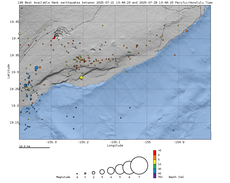
Map showing locations of earthquakes during the past week. Bottom: Depth of earthquakes (circles) during the past week. Circle-size represents magnitude, and color indicates depth. An interactive earthquake plot can be found on the HVO Earthquakes page.
Sources/Usage
Public Domain.