
Elevation difference maps of Brigantine, New Jersey
Detailed Description
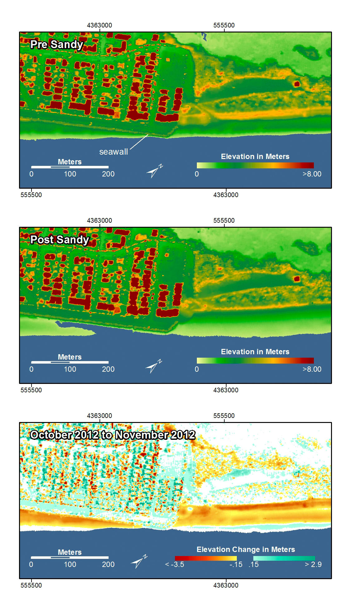
Pre-storm elevation map, post-storm elevation map, and elevation difference map of Brigantine, New Jersey. This area consists of a developed area on the left and an undeveloped area on the right. The beach in front of the seawall on the developed side was eroded and storm surge and waves overwashed the seawall depositing sand on the island. On the undeveloped side, the seaward side of the dunes and the beach were eroded resulting in a flatter and wider beach.
In the pre- and post-storm elevation maps, orange and red colors indicate higher elevations while yellow and green colors indicate lower elevations. In the elevation difference maps, red colors indicate erosion such as shoreline retreat, and blue-green colors indicate accretion, such as overwash deposits where waves and surge have moved sand landward. Maps are oriented with the Atlantic Ocean on the bottom.
Sources/Usage
k