
Elevation difference maps of Stone Harbor Point, New Jersey

Detailed Description
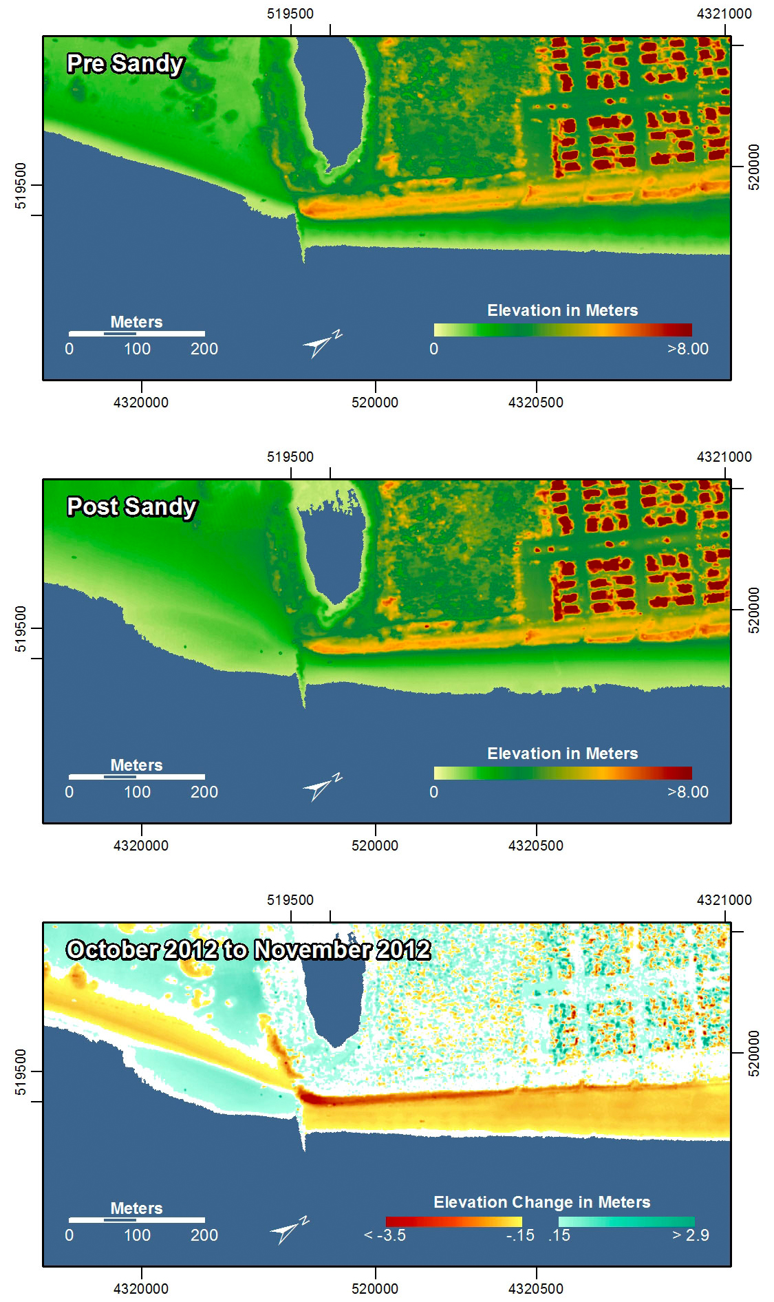
Pre-storm elevation map, post-storm elevation map, and elevation difference map of Stone Harbor Point, New Jersey. On the right side of the image, north of the groin, the beach and seaward facing edge of the dunes were eroded, showing a typical example of the collision regime. On the left, south of the groin, the beach was flattened and widened by storm surge and waves overwashing the area.
In the pre- and post-storm elevation maps, orange and red colors indicate higher elevations while yellow and green colors indicate lower elevations. In the elevation difference maps, red colors indicate erosion such as shoreline retreat, and blue-green colors indicate accretion, such as overwash deposits where waves and surge have moved sand landward. Maps are oriented with the Atlantic Ocean on the bottom.
Sources/Usage
Public Domain.