
Elevations of various surfaces and features at Pu‘u ‘Ō‘ō

Detailed Description
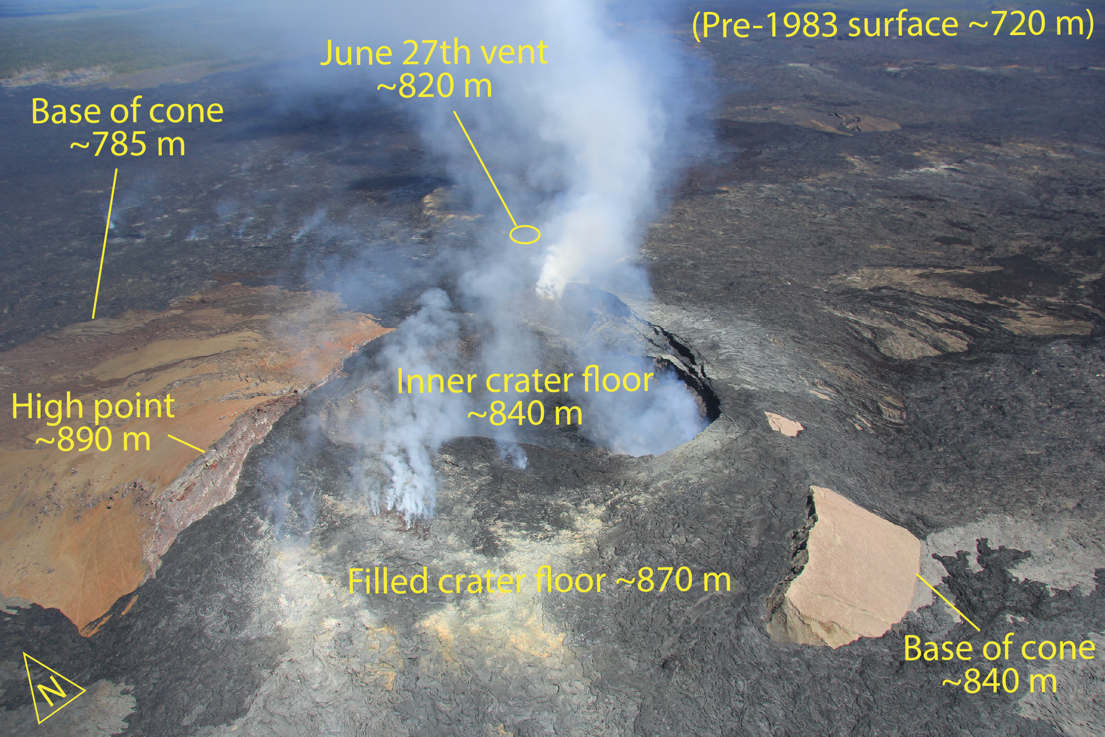
When Pu‘u ‘Ō‘ō began to form in 1983, the ground surface on which it was built was at an elevation of about 720 m (~2,360 ft). The Pu‘u ‘Ō‘ō cone eventually reached a height of 255 m (837 ft), putting its top at an elevation of about 975 m (~3,200 ft). Because the cone has progressively collapsed since the late 1980's, the current high point, on the cone's northwest rim, has an elevation of about 890 m (~2,920 ft).
Filling of the Pu‘u ‘Ō‘ō crater during 2013 and early 2014 brought the crater floor to an elevation of about 870 m (~2,854 ft). After the onset of the June 27th lava flow, a smaller crater formed on the eastern side of the filled crater floor. The solid floor of this smaller crater (it's not a lava lake) is at an elevation of about 840 m (~2,756 ft). This is the same elevation as the exposed base of the south flank of the Pu‘u ‘Ō‘ō cone. The elevation of the exposed base of the north flank of Pu‘u ‘Ō‘ō is quite a bit lower at about 785 m (~2,575 ft). The June 27th vent is at an elevation of about 820 m (~2,690 ft). The distance from the high point on the northwest rim to the south rim (from left to right in this photo) is about 300 m (~980 ft).