
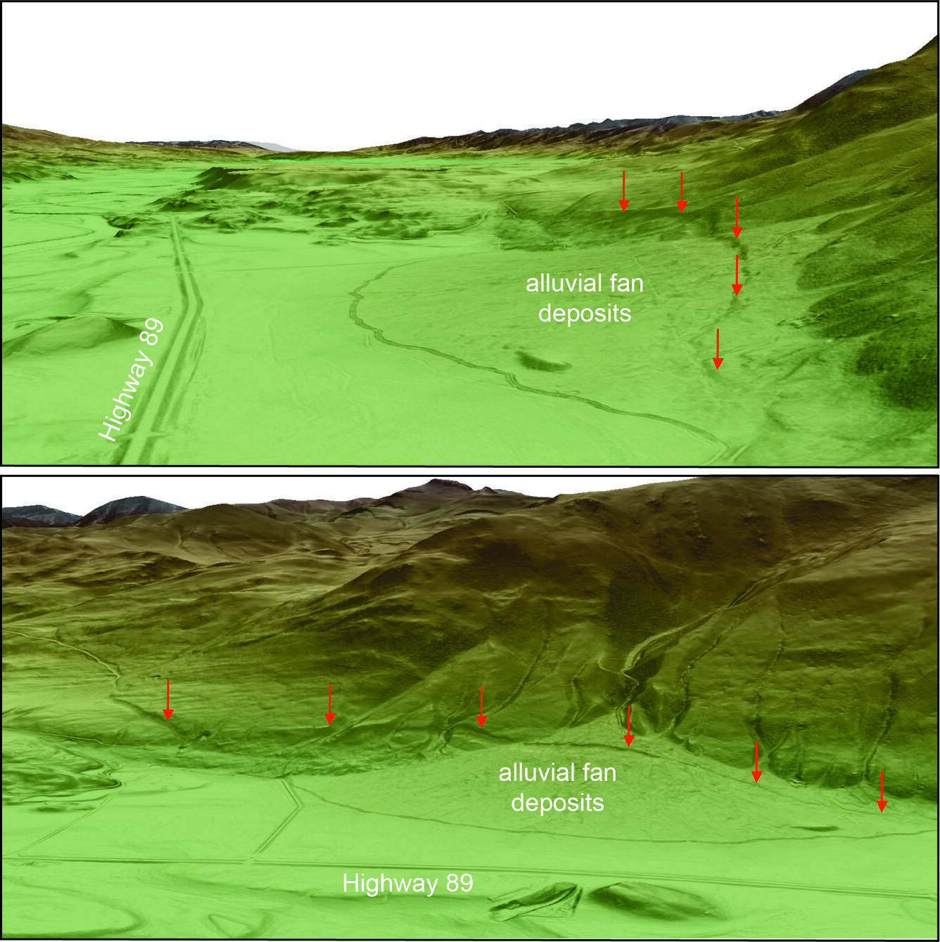
Shaded relief maps based on lidar data and showing fault scarps in Paradise Valley, Montana
Detailed Description
Shaded relief maps based on lidar data and showing fault scarps in Paradise Valley, Montana. Lidar imagery is given as a colored, shaded slope map, with higher elevations in brown and white, and lower elevations in green. Darker shading indicates steeper slopes. Top image is a northwestward view (toward Livingston) of Paradise Valley near Carbella. The right side of the image shows an oblique perspective of the Emigrant fault scarp (shown by red arrows) that vertically offset young alluvial fan deposits. Highway 89 is visible on the left side of the image as a pair of parallel lines. Bottom image is a southeastward view showing the same fault scarp. Subtle flutes and ridges extending horizontally across the hillslopes above the scarps were carved by glacial ice flowing down the Emigrant Valley from the Yellowstone ice cap. (Lidar visualization by Yann Gavillot, MBMG, using 3-D scene in ArcGis Pro).
Sources/Usage
Public Domain.