
Episode 61 (Peace Day) flow field on coastal plain

Detailed Description
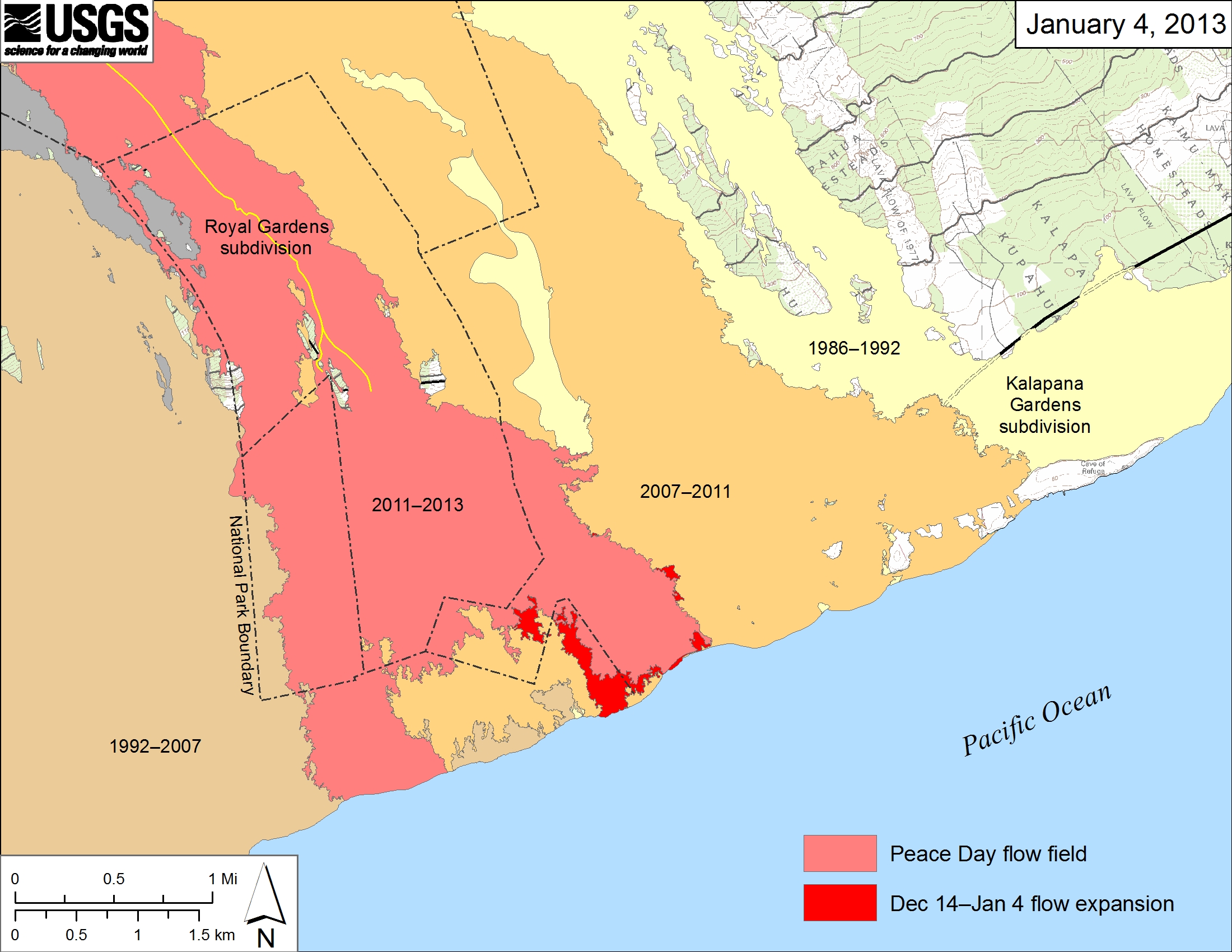
Large-scale map showing the mapped flow expansion on the coastal plain between December 14, 2012, and January 4, 2013 (in bright red). Light red represents the extent of the Peace Day flow from September 21, 2011, to December 14, 2012. Older flows are labeled with the years in which they were active. Changes to the perimeter of the flow farther upslope, from recent flows near the top of Royal Gardens subdivision,were not mapped and so are not shown here.