
Existing USGS groundwater-level networks enhanced map
By Ohio-Kentucky-Indiana Water Science Center
May 2023 (approx.)

Detailed Description
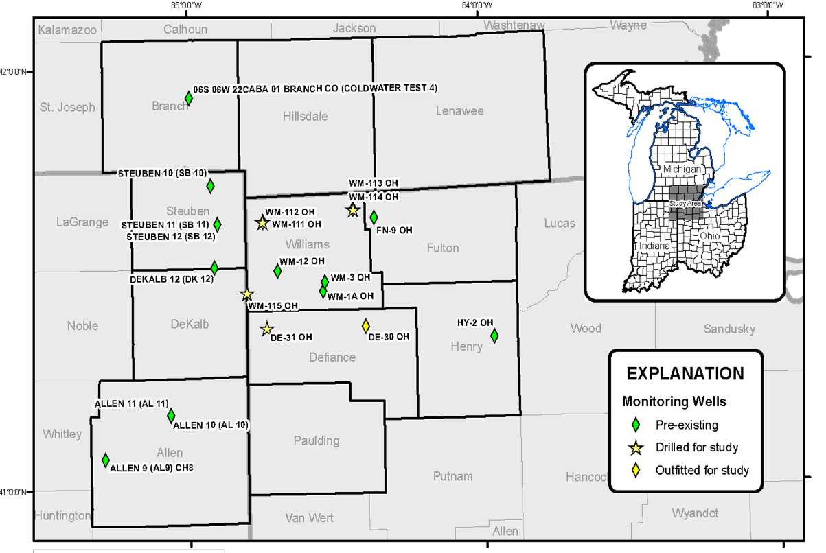
Existing USGS groundwater-level networks were enhanced through: 1) the addition of newly drilled deep wells that nearly reach bedrock, and 2) conversion of discrete wells to continuous, real-time wells
Sources/Usage
Public Domain.
USGS OKI Water Science Center, 2023
Related

Hydrogeologic Mapping and Three-Dimensional Geologic Modeling of Glacial Deposits in a Multicounty Area of Southeastern Michigan, Northeastern Indiana, and Northwestern Ohio
Groundwater resources in southern Michigan, northeastern Indiana, and northwestern Ohio, have been a recurring subject of interest related to sources of public, irrigation, and other water supplies and the potential of glacial deposits to supply water to adjacent parts of Ohio. The glacial deposits that are part of the aquifer system informally known as the “Michindoh aquifer” are a principal...
Related
Hydrogeologic Mapping and Three-Dimensional Geologic Modeling of Glacial Deposits in a Multicounty Area of Southeastern Michigan, Northeastern Indiana, and Northwestern Ohio
Groundwater resources in southern Michigan, northeastern Indiana, and northwestern Ohio, have been a recurring subject of interest related to sources of public, irrigation, and other water supplies and the potential of glacial deposits to supply water to adjacent parts of Ohio. The glacial deposits that are part of the aquifer system informally known as the “Michindoh aquifer” are a principal...