
FIM library creation, Step 5, Geospatial Processing

Detailed Description
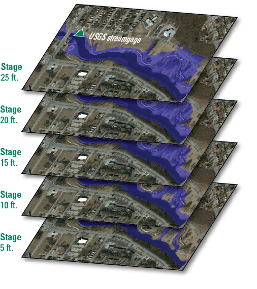
Figure 6. In the final step, the inundation maps are overlaid onto city maps, and the entire set of maps is collected into a flood inundation map library. The community can use both the individual maps and the entire series understand the pattern of flooding in their areas and identify the areas and resources most at risk.
Sources/Usage
Public Domain.
Related

Flood Inundation Mapping Science
When planning for a flood, there are three key questions that must be answered: What areas will be flooded? How deep will the flood waters get? When will the flood arrive? Historical flooding can help a community anticipate how much impact similar flood events could have, but there are other methods and tools that can provide more accurate and nuanced estimations of a wide variety of flood...
Related
Flood Inundation Mapping Science
When planning for a flood, there are three key questions that must be answered: What areas will be flooded? How deep will the flood waters get? When will the flood arrive? Historical flooding can help a community anticipate how much impact similar flood events could have, but there are other methods and tools that can provide more accurate and nuanced estimations of a wide variety of flood...