
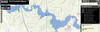
Flood inundation mapping - Interactive floodplain mapping tool.

Detailed Description
The USGS Flood Inundation Mapper
——————————————————
Floods are the leading cause of natural-disaster losses in the United States. Although the amount of fatalities has declined due to improved early warning systems, economic losses have continued to rise with increased urbanization in flood-hazard areas. The USGS Flood Inundation Mapping (FIM) Program helps communities protect lives and property by providing tools and information to help them understand their local flood risks and make cost-effective mitigation decisions.
The USGS Flood Inundation Mapping Program has two main functions:
1) Partner with local communities to assist with the development and validation of flood inundation map libraries.
2) Provide online access to flood inundation maps along with real-time streamflow data, flood forecasts, and potential loss estimates.
Sources/Usage
Public Domain.
Related

Floods and the South Atlantic Water Science Center
Related