
Gap Analysis Species U.S. regional boundaries map
Detailed Description
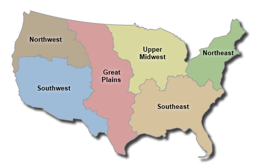
Regions used for species modeling
The lower 48 states of the U.S. were divided into six regions for modeling purposes.
Each of the ancillary data layers are split into these six regions and models were
run within a region and regional model output were compiled to create a complete
distribution model across a species range. The regions are based on grouped MRLC
zones.
- Northwest
- Southwest
- Great Plains
- Upper Midwest
- Southeast
- Northeast
Sources/Usage
Public Domain.