
Geologic mapping and sampling in Alaska

Detailed Description
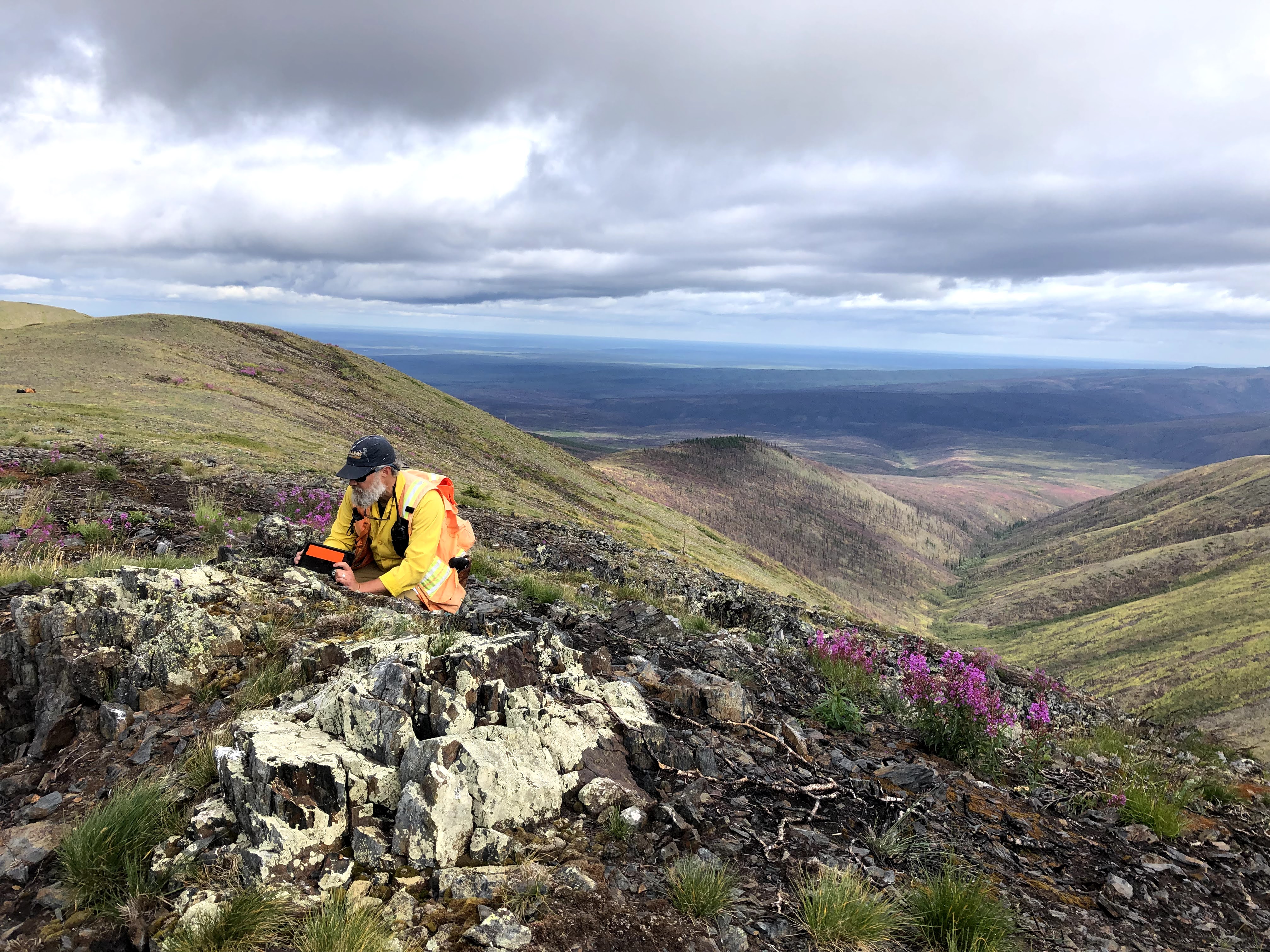
A USGS scientist is conducting geologic mapping and collecting structural measurements from a bedrock outcrop in the West Crazy Mountains in eastern interior Alaska. The rock is metamorphosed chert that was originally deposited more than 350 million years ago in an ocean basin that was likely separated from present-day North America. Geologic mapping and structural geologic studies help to identify the tectonic origins of different rock packages and trace the history of their formation, migration, and eventual incorporation into the complex geologic collage of Alaska. This information is used to construct new geologic maps that illustrate the geologic evolution of the region together with the formation and distribution of key mineral deposits. These maps and associated analytical data improve mineral resource assessments and provide information that supports a variety of stakeholder needs.
Sources/Usage
Public Domain.
Adrian Bender, U.S. Geological Survey