
Geomorphic reaches studied by USGS, Siletz River, Western Oregon
Detailed Description
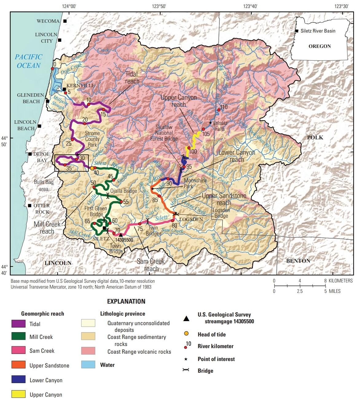
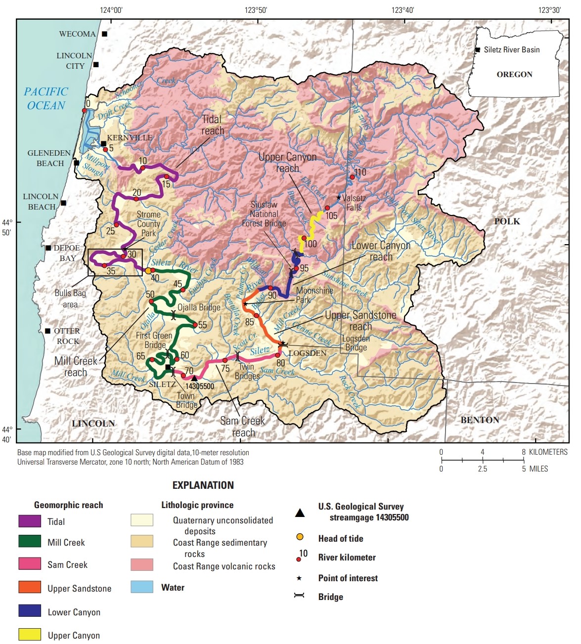
Geologic map of the Siletz River Basin showing rock types and six geomorphic reaches from the coast inland: Tidal, Mill Creek, Sam Creek, Upper Sandstone, Lower Canyon, and Upper Canyon. The Tidal reach flows through a mix of volcanic rocks, sedimentary rocks, and unconsolidated deposits. Mill Creek, Sam Creek, and Upper Sandstone reaches flow through sedimentary rocks and unconsolidated deposits. The Lower and Upper Canyon reaches flow through mostly volcanic rocks of the Coast Range.
Sources/Usage
Public Domain.
Related

Controls on habitat for native lamprey in the Siletz River Basin
Chinook Salmon and Pacific Lamprey are culturally significant fishes to the Tribal community along the Siletz River, Oregon. The USGS studied how streamflow and bedload conditions may influence mainstem spawning habitats.
Related
Controls on habitat for native lamprey in the Siletz River Basin
Chinook Salmon and Pacific Lamprey are culturally significant fishes to the Tribal community along the Siletz River, Oregon. The USGS studied how streamflow and bedload conditions may influence mainstem spawning habitats.