
GroundFailure-Figure-Landslidesgrid.gif

Detailed Description
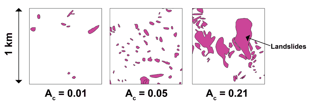
This figure shows three 1 km2 grid cells selected from the Northridge earthquake-triggered landslide inventory (Harp and Jibson, 1995) and corresponding areal coverage values (Ac) for each cell. Landslide maps, including this case, typically include both landslide source areas and landslide runout zones. Note that many small landslides or one large landslide may result in the same areal coverage value, so the models do not explicitly provide any information about expected ground failure size. Also note that a probability of 0.21 equates to severe landsliding. Neither of the models ever reaches a probability of 1; the maximum probabilities are usually less than 0.3.
Sources/Usage
Public Domain.
This figure shows three 1 km2 grid cells selected from the Northridge earthquake-triggered landslide inventory (Harp and Jibson, 1995) and corresponding areal coverage values (Ac) for each cell. Landslide maps, including this case, typically include both landslide source areas and landslide runout zones. Note that many small landslides or one large landslide may result in the same areal coverage value, so the models do not explicitly provide any information about expected ground failure size. Also note that a probability of 0.21 equates to severe landsliding. Neither of the models ever reaches a probability of 1; the maximum probabilities are usually less than 0.3.