
GWSIP Performance Measure #1: National Streamflow Network
Detailed Description
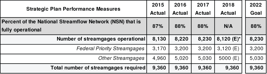
The USGS National Streamflow Network (NSN) is the national network of streamgages that is used to provide accurate flood forecasting and assessments with the National Weather Service (NWS) and the Federal Emergency Management Agency (FEMA); provide data for bridge designs, water-supply studies, and interstate/international transfers; industrial uses; long-term climate trends; and so many other societal needs. The USGS has two sources of Groundwater and Streamflow Information Program (GWSIP) funding for this network: dedicated base funding for Federal Priority Streamgages and Cooperative Matching Funds (CMF) that are used to partner with State, regional, local, and tribal cooperators. With these funds, the USGS strives to expand the current number of Federal Priority Streamgages providing real-time data from 3,460 to 4,760 and optimize the number of streamgages that can be funded by CMF. This performance measure tracks how the USGS is progressing in reaching that goal. This table shows a snapshot of the performance measure history and the 2022 goal aligned with the 2018-2022 DOI Strategic Plan.
Sources/Usage
Public Domain.