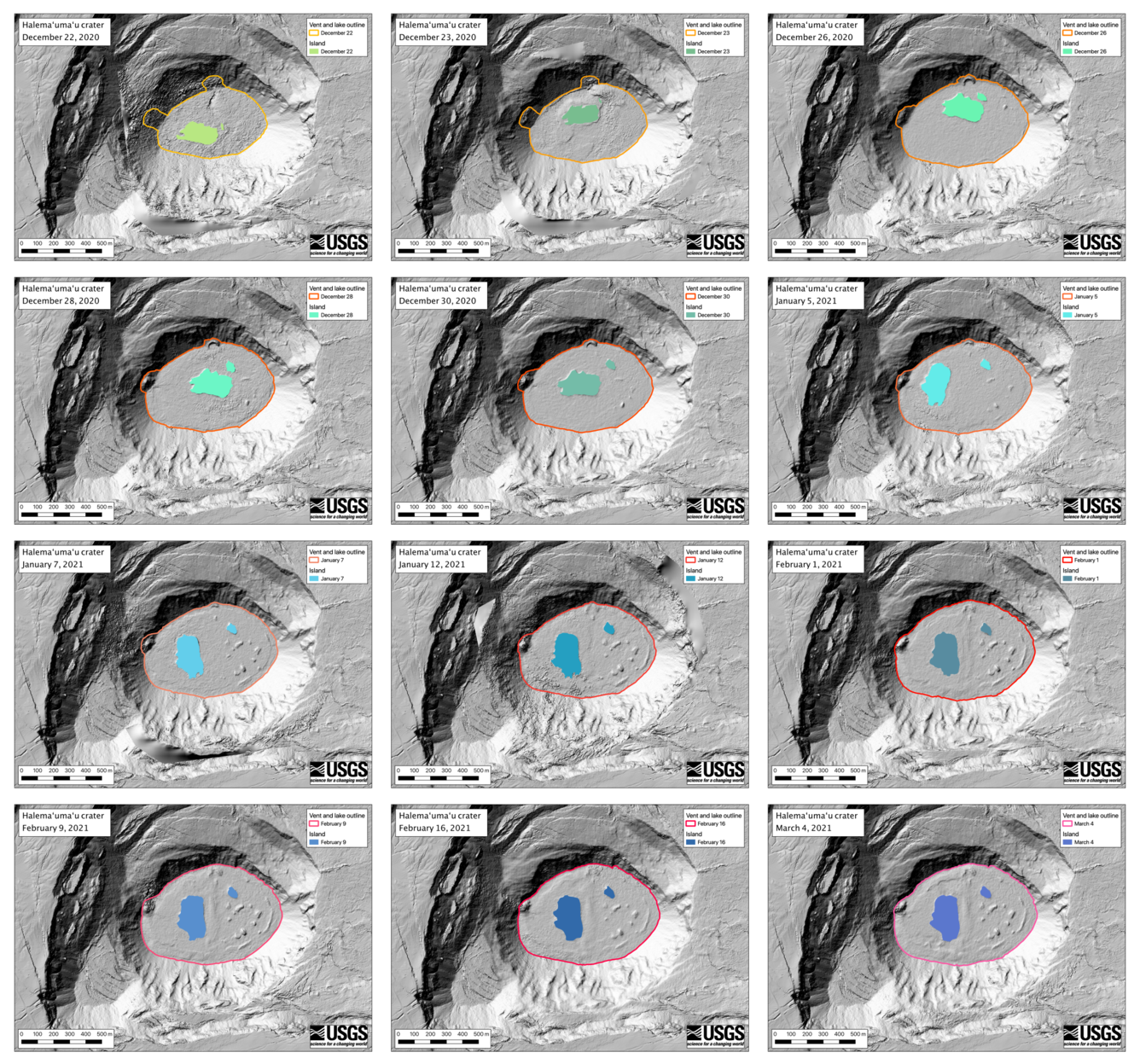
Halema‘uma‘u eruption sequence Digital Elevation Models

Detailed Description
HVO uses regular Kīlauea summit helicopter overflights of Halema‘uma‘u crater to create digital elevation models (DEMs) of the crater. The DEMs show changes in the crater over time and can be used to estimate erupted volume, eruption rate, and map features of interest. In this sequence of DEMs, the rise of the lava lake can be clearly tracked as well as the movement of the largest two islands. The main island formed in the southern part of the lava lake and moved north (first row). Then, after the primary source of lava switched from the north vent to west on December 26, the main island moved back to the south and then rotated 90 degrees counterclockwise (second and third rows). The main island has remained stationary since about January 12 (bottom row). This sequence also shows how a smaller island that initially tracked with the main island (top row) separated at the end of December (second row) and has remained stationary since early January (third and fourth rows). In these maps North is oriented towards the top. The basemap is a pre-eruption DEM from 2019.
Sources/Usage
Public Domain.

