
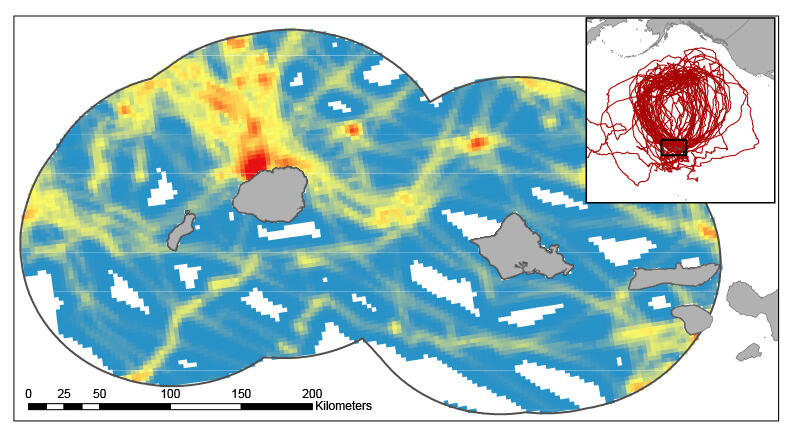
Heat Map of Endangered Hawaiian Petrel
Detailed Description
An example “heat” map of endangered Hawaiian petrel commuting corridors within 100 kilometers of the Hawaiian islands of Kauai and Oahu where red indicates areas of higher use. Images such as this one can can inform policymakers working to mitigate the risk of renewable energy on seabirds. Credit: Josh Adams, USGS