
Helicopter Making Low-Level Flights over North-Central Idaho
By Communications and Publishing
September 2021 (approx.)

Detailed Description
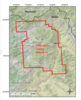
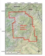
Map shows the airborne helicopter survey west of nearby Salmon, just south of Montana-Idaho border (bold black line). Surveys will be conducted within/near the boundary margins (red polygon). Planned flight lines and survey information can be found online.
Sources/Usage
Public Domain.