
HEMI Model Boundary Southwest Michigan
By Upper Midwest Water Science Center
August 2025 (approx.)
Detailed Description
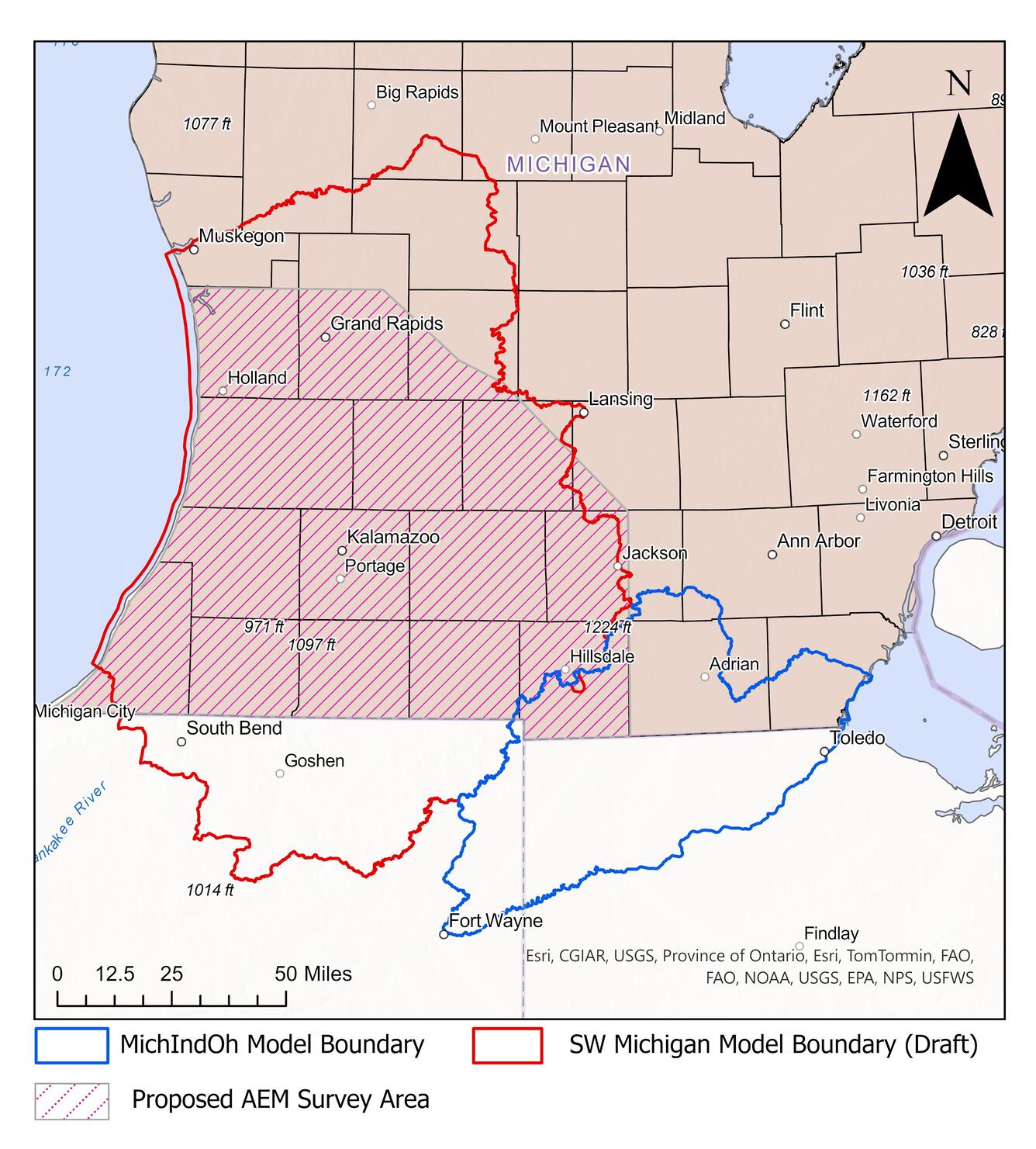
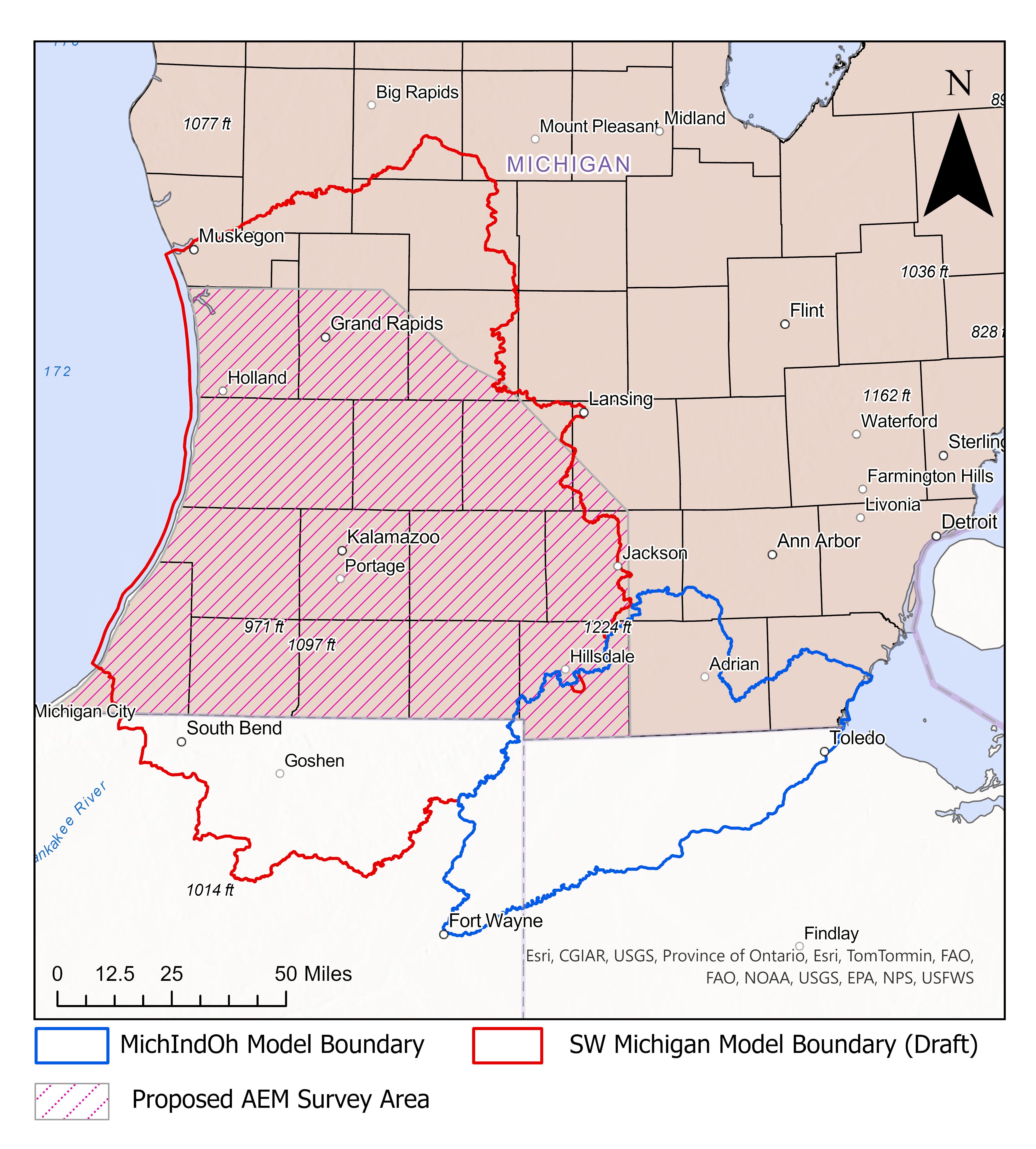
Map depicting boundaries of the Southwest Michigan Model, which is being developed by USGS as part of the HEMI project. This model will use the characterization of subsurface materials provided by the airborne electromagnetic surveys being carried out as part of the project. The boundary of another USGS groundwater modeling effort encompassing the southeastern border of Michigan, the MichIndOh model, is also depicted.
Sources/Usage
Public Domain.
Related
Hydrologic Enhancement for Michigan (HEMI)
USGS partners with Michigan’s Department of Environment, Great Lakes, and Energy (EGLE) to enhance Michigan’s data on water resources Hydrologic Enhancement for Michigan (HEMI)
Related
Hydrologic Enhancement for Michigan (HEMI)
USGS partners with Michigan’s Department of Environment, Great Lakes, and Energy (EGLE) to enhance Michigan’s data on water resources Hydrologic Enhancement for Michigan (HEMI)