
High precision GPS antenna, YNP.
By Volcano Hazards Program
1905 (approx.)
Detailed Description
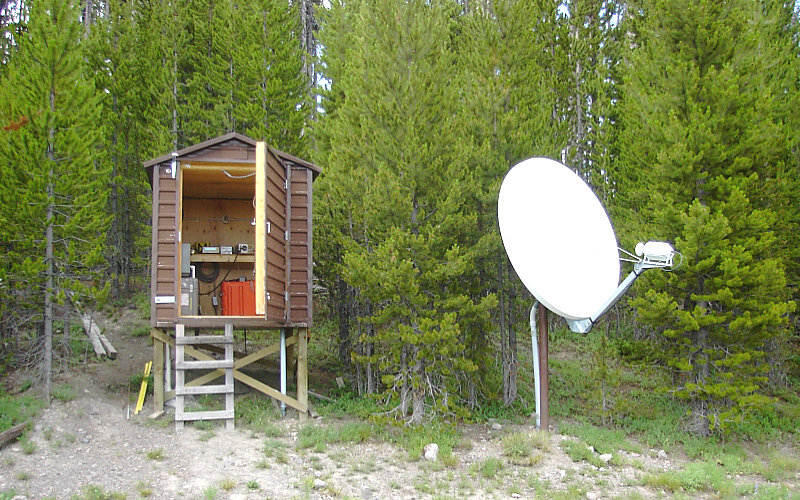
The Lake seismic and GPS observatory. This facility houses a modern digital recording seismograph operated cooperatively by the University of Utah with the USGS National Earthquake Center. The site also includes a high-precision, continuous-recording, GPS receiver. Data from both instruments are transmitted in real-time by satellite (satellite dish shown). From the GPS information, the position of the earth at this point can be determined to a high precision of centimeters. By comparing the positions of the station with time, scientists can determine the velocity of the ground motion that can be affected by magma flow and plate motions.
Sources/Usage
Public Domain.