
Historic Tour - Marble Canyon

Detailed Description
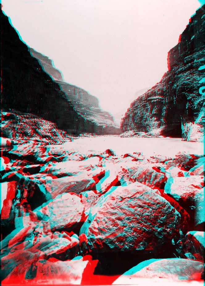
Grand Canyon National Park, Arizona. Marble Canyon. 1872. From Lees Ferry, the Colorado River descends into a canyon lined with Paleozoic-age sedimentary rocks, mostly limestone and dolomite. This motivated Powell to name the river gorge Marble Canyon. Downstream through Marble Canyon rocks of increasing age are exposed at river level. For nearly 50 miles downstream of Lees Ferry, limestone, sandstone, and shale formations of late Paleozoic age (Devonian to Permian in age) crop out in the riverside cliffs. Rocks of each sedimentary formation have unique, recognizable characteristics (including fossils). These formations form the step-like benches in the canyon seen in the distance in this photograph of Marble Canyon. From youngest (top) to oldest (bottom) these included the Kaibab Limestone (highest cliff), Toroweap Formation (slope), Coconino Sandstone (second cliff), Hermit Shale (wide slope), the Supai Group (cliffs and slope above first cliff), and the Redwall Limestone (cliff at river level).
Sources/Usage
Public Domain.