
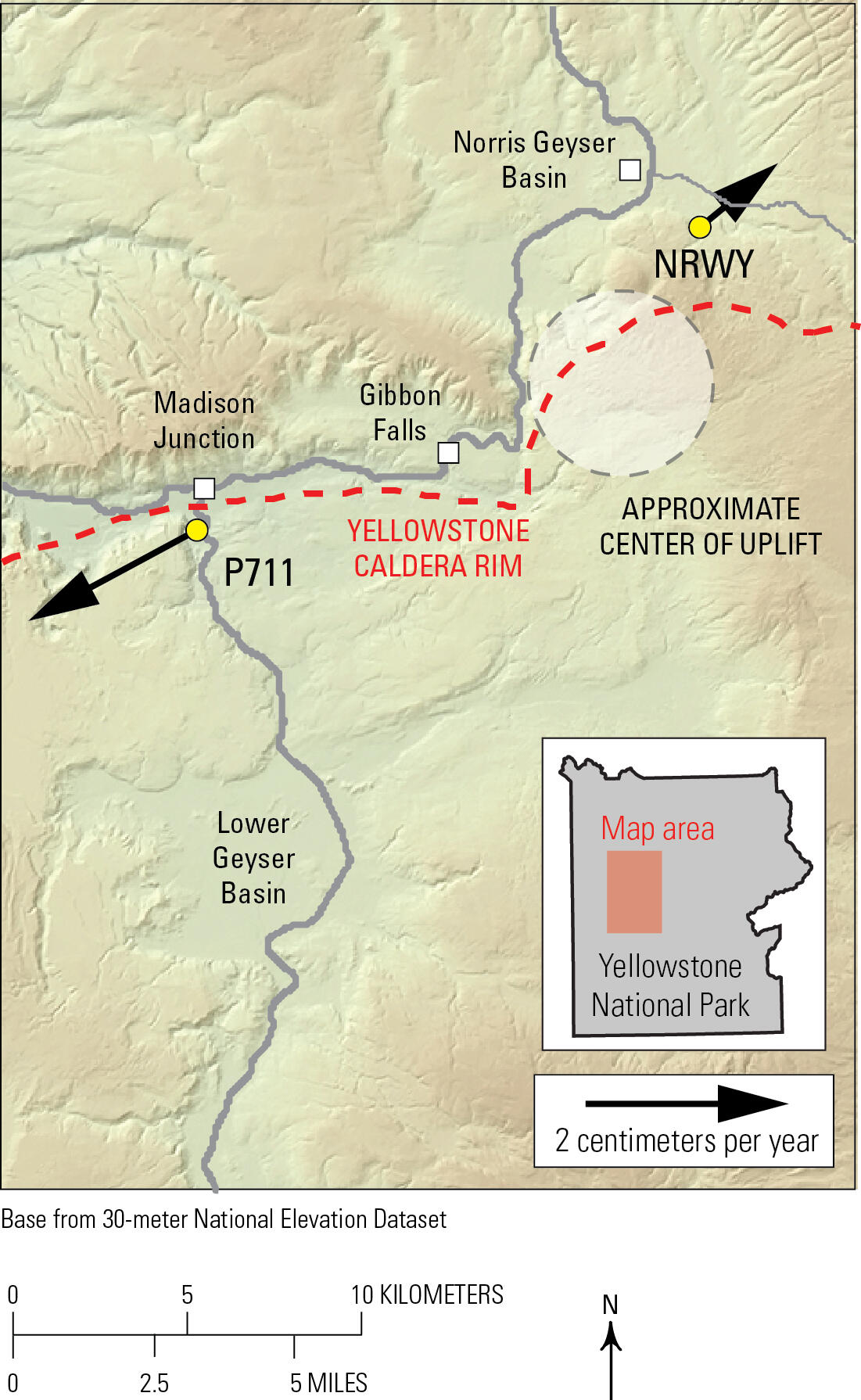
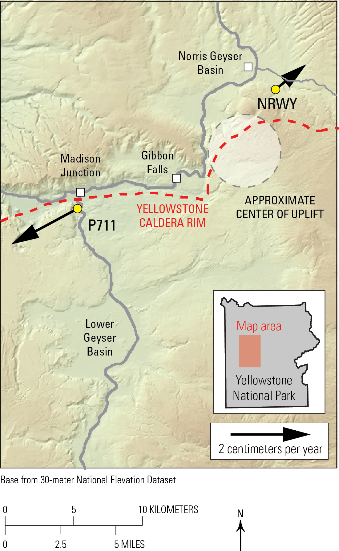
Horizontal GPS velocities during July-December 2025 in the Madison and Norris areas of Yellowstone National Park
By Yellowstone Volcano Observatory
January 2026 (approx.)
Detailed Description
Map of horizontal velocities between July and December 2025 at Global Positioning System (GPS) stations P711 and NRWY (arrows and yellow circles) in the area between Norris Geyser Basin and Madison Junction. Dashed red line indicates boundary of Yellowstone Caldera and gray lines are roads. White circle is approximate center of uplift that became active in July 2025. Length of arrows indicates rate of displacement.
Sources/Usage
Public Domain.
Related
Uplift along the north rim of Yellowstone Caldera
An area on the north rim of Yellowstone caldera, to the south of Norris Geyser Basin, started to uplift slightly in July 2025. Similar deformation occurred in the same area during 1996-2004 and reveals characteristics of the subsurface.
Related
Uplift along the north rim of Yellowstone Caldera
An area on the north rim of Yellowstone caldera, to the south of Norris Geyser Basin, started to uplift slightly in July 2025. Similar deformation occurred in the same area during 1996-2004 and reveals characteristics of the subsurface.