
Hurricane Michael Pre- and Post-Storm Photo Comparisons - St. George
Detailed Description
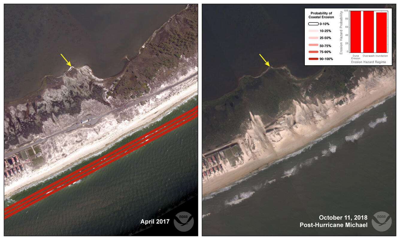
Location 10: Low-elevation dunes (< 8 feet (2.5 meters)) on St. George Island were overtoped by Michael’s storm surge and large waves. Sand was transported over the beach and dunes more than 200 meters landward and covers the only access road into St. George Island State Park. The predicted probability of overwash for this location was 100%.
Sources/Usage
Public Domain.