
Illustration of airborne lidar acquisition platform
By St. Petersburg Coastal and Marine Science Center
2003 (approx.)
Detailed Description
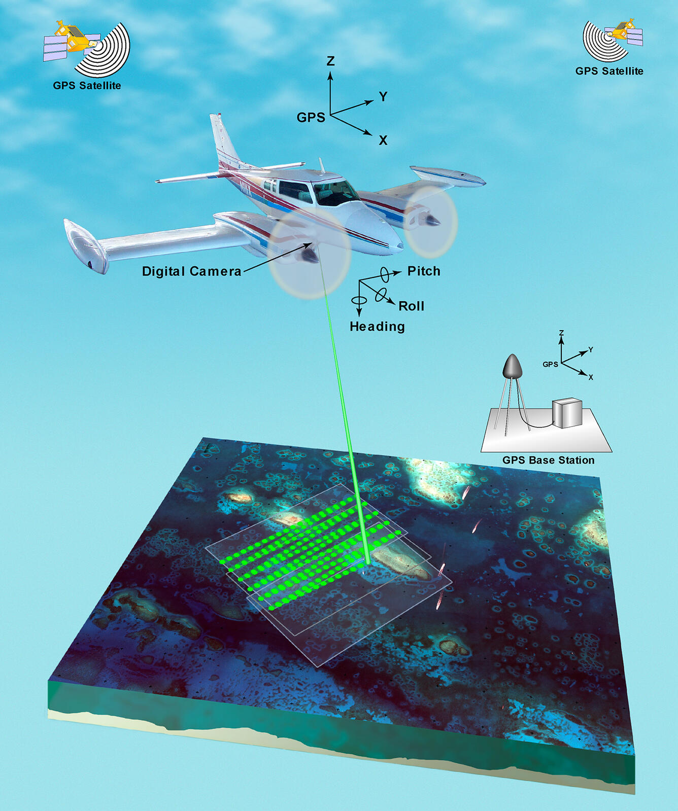
Airborne lidar is a surveying method that measures distance to a target from a survey plane by illuminating that target with a pulsed laser light, and measuring the reflected pulses with a sensor. Differences in laser return times and wavelengths can then be used to make digital 3D-representations of the target. This illustration depicts the equipment used, including the plane with digital camera mounted underneath, the GPS base station, and the satellites used to obtain the coordinates.
Sources/Usage
Public Domain.
Related

Use of Lidar in Coastal Studies
Since 1998, airborne light detection and ranging, or lidar, capabilities have been developed and utilized to support CMHRP research projects and hazard assessments. Lidar is a remote-sensing technique that measures distance to a target by sending out light energy and detecting how long it takes the reflected pulses to return to the sensor. Lidar data provide information about the elevation, shape...
Related
Use of Lidar in Coastal Studies
Since 1998, airborne light detection and ranging, or lidar, capabilities have been developed and utilized to support CMHRP research projects and hazard assessments. Lidar is a remote-sensing technique that measures distance to a target by sending out light energy and detecting how long it takes the reflected pulses to return to the sensor. Lidar data provide information about the elevation, shape...