
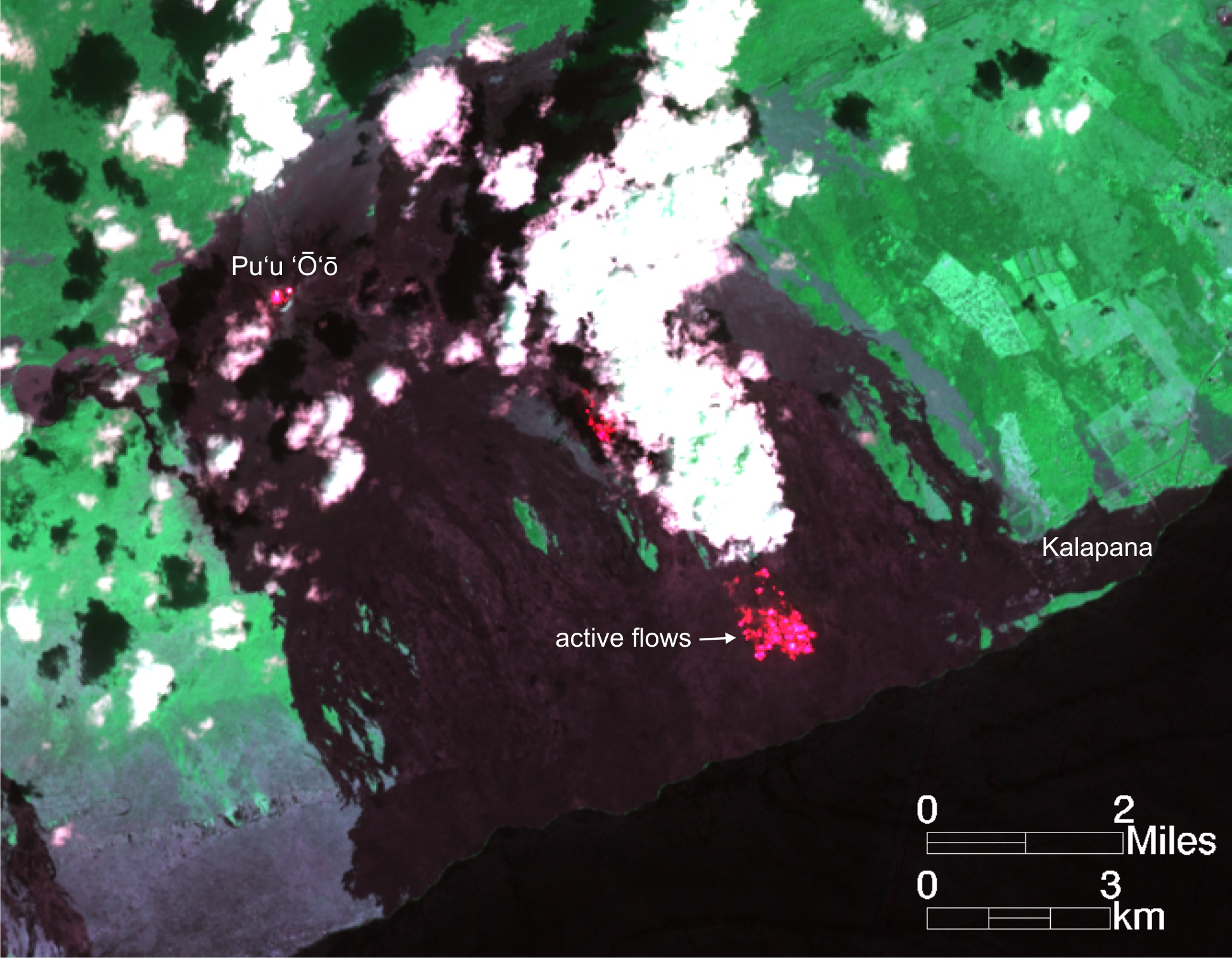
Image of active breakouts on coastal plain

Detailed Description
This image was captured on Saturday, November 3, by the Advanced Land Imager sensor aboard NASA's Earth Observing 1 satellite. Although this is a false-color image, the color map has been chosen to mimic what the human eye would expect to see. Bright red pixels depict areas of very high temperatures, and show active or very recently active lava flows. The largest area of active surface flows this past week has been on the coastal plain, shown by the large area of red pixels near the ocean. These flows were 1.1 km (0.7 miles) from the water. A smaller area of breakouts is active near the top of the pali, shown by the small area of red pixels partly obscured by clouds in the center of the image. Lava within Pu‘u ‘Ō‘ō crater is also visible in this image.