
Image of area around flow front
Detailed Description
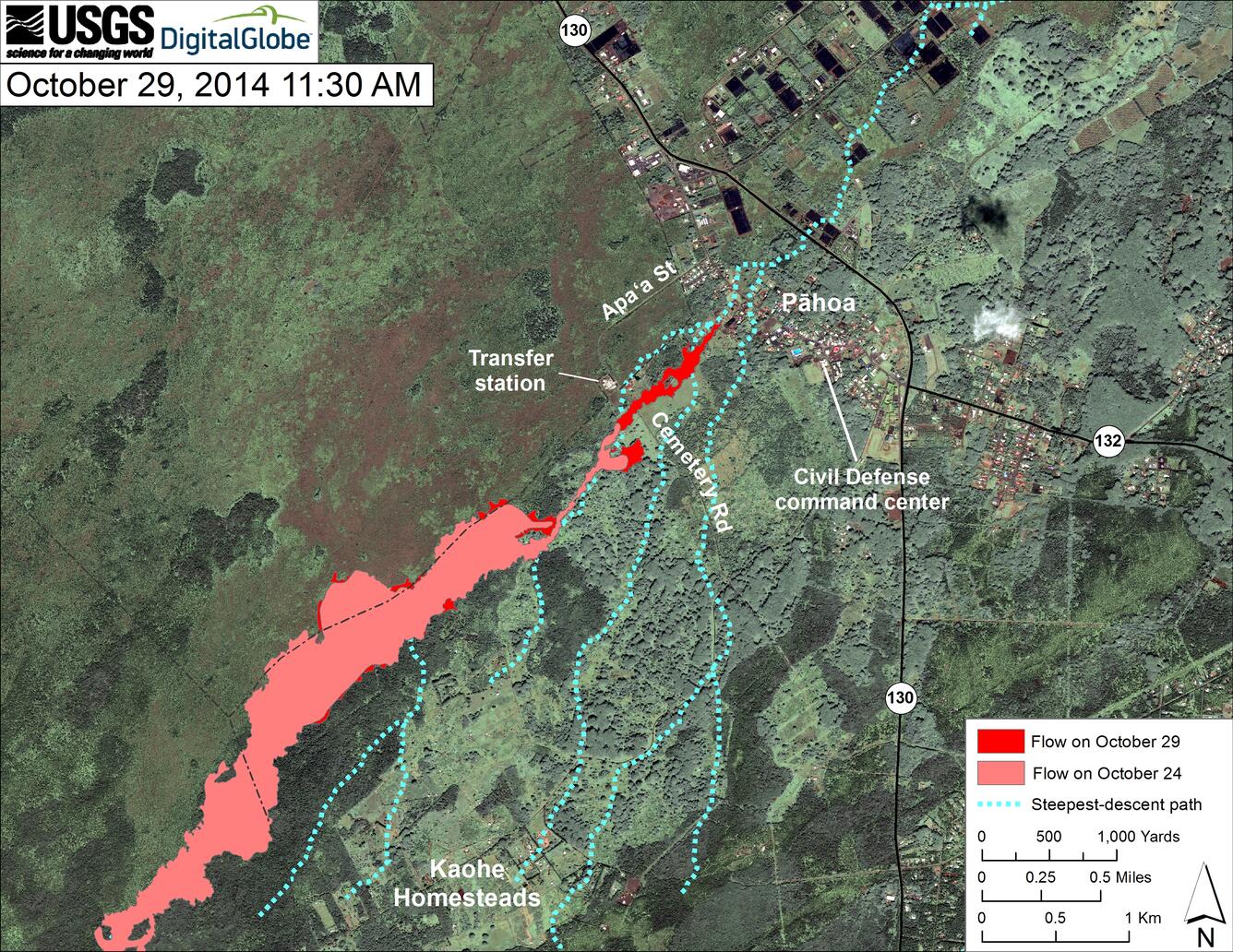
This map uses a satellite image acquired in March 2014 (provided by Digital Globe) as a base to show the area around the front of the June 27th lava flow. The area of the flow on October 24, 2014, at 12:10 PM is shown in pink, while widening and advancement of the flow as mapped on October 29 at 11:30 AM is shown in red.
The front of the June 27th flow continues to advance as a narrow finger, and was 215 meters (235 yards) upslope from Pāhoa Village Road at the time of mapping. The flow front was up about 50 meters (55 yards) wide, but was much narrower in some areas where its width was confined by topography and obstacles.