
Image of ongoing lava flow activity
Detailed Description
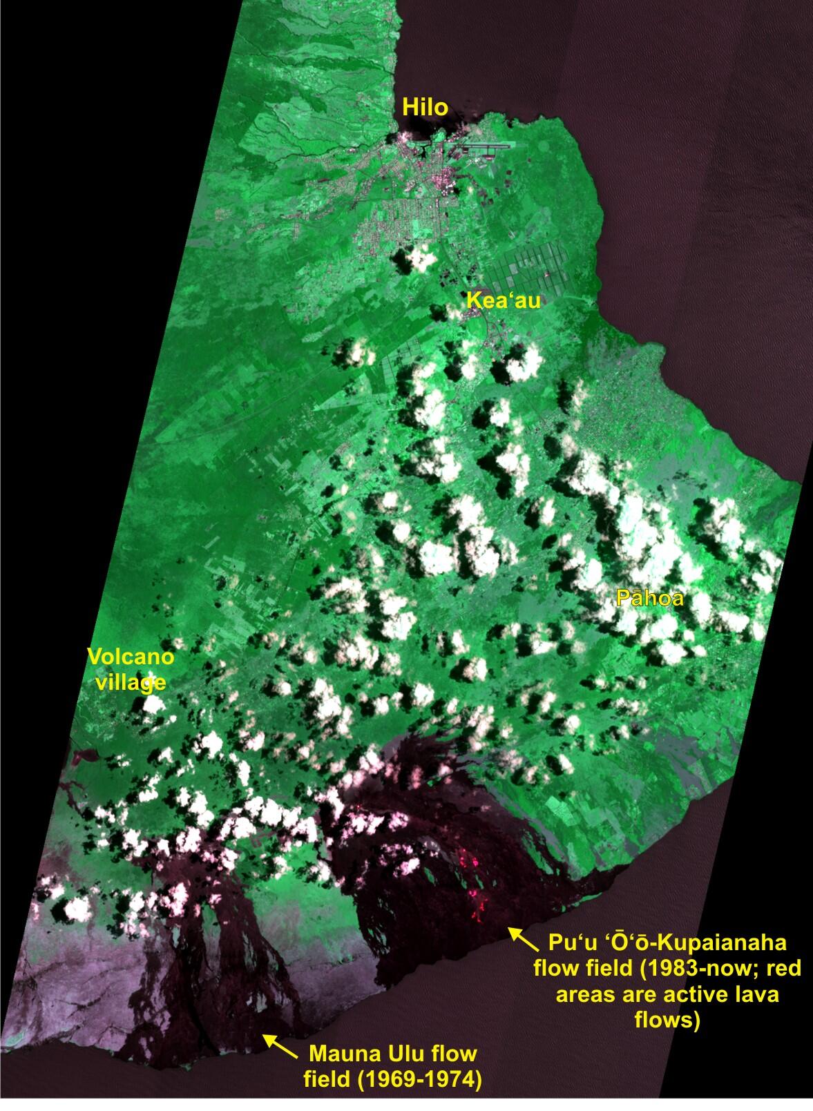
This false-color satellite image shows the ongoing lava flow activity on the east rift zone of Kīlauea volcano along with nearby cities and towns on the east side of the Big Island. The image was acquired at 10:28 am on June 12 by the Advanced Land Imager sensor aboard the NASA Earth Observing 1 satellite. The image consists of several near-infrared and shortwave infrared channels combined in such a way as to mimic those colors expected by the human eye. Two recent flow fields on Kīlauea are obvious: the Mauna Ulu flow field, active between 1969 and 1974, and the current Pu‘u ‘Ō‘ō - Kupaianaha flow field that began in 1983. Today, scattered flows were active in the middle of the flow field and were slowly migrating towards the ocean. These active breakouts are evident as bright red spots in the image; the flow front was about 1.3 km (0.8 miles) from the water. The area spanned by the active flows in the image is about 4.2 km (2.6 miles) long, which is about 40% longer than the main runway at Hilo International Airport (near the top of the image). In addition to regular field visits and continuously-operating webcams, satellite images are another tool that HVO uses to monitor flow field activity. Click on the image above for a higher resolution version of the image.