
Image showing a conceptual model of the Truxton Basin and Hualapai Plateau groundwater-flow system in northwestern Arizona
Detailed Description
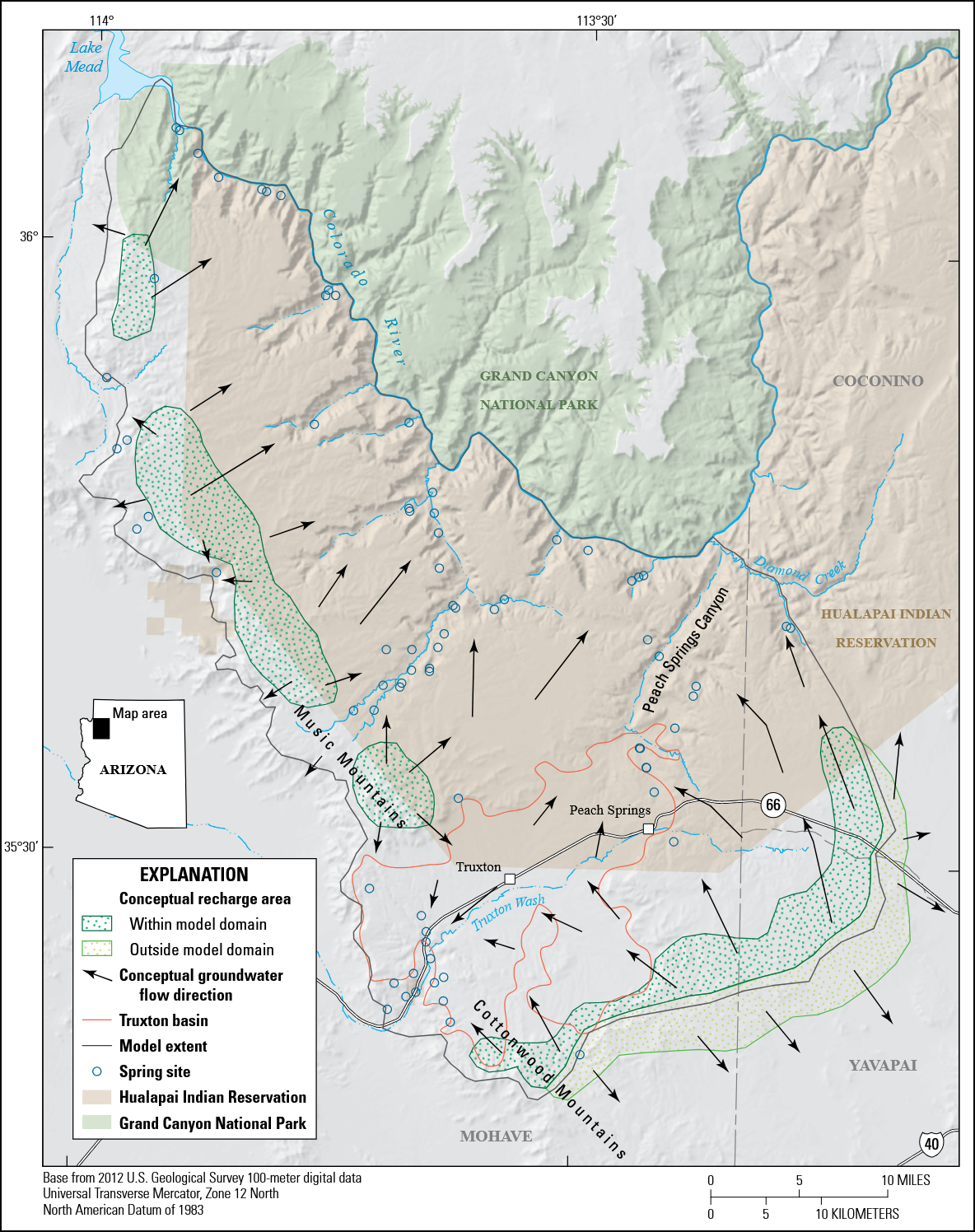
This report includes five chapters. Chapter A (Mason, Knight, and others, 2020) is a summary of this multichapter volume and briefly describes the study area. Chapter B (Mason, Bills, and Macy, 2020) describes the geology and hydrology of the Truxton basin and Hualapai Plateau. Chapter C (Kennedy, 2020) describes the results of a gravity geophysical survey of the Truxton basin. Chapter D (Ball, 2020) describes the findings of an airborne electromagnetic survey of the Truxton aquifer and Hualapai Plateau. Chapter E (Knight, 2020) describes the results of a transient groundwater model created for the entire Truxton aquifer both on and off the reservation. The groundwater-flow model is used to estimate projected groundwater levels based on future groundwater withdrawal scenarios.
Sources/Usage
Public Domain.
USGS illustration--public domain