
INLPO Network Sites
By Idaho Water Science Center
January 2025 (approx.)
Detailed Description
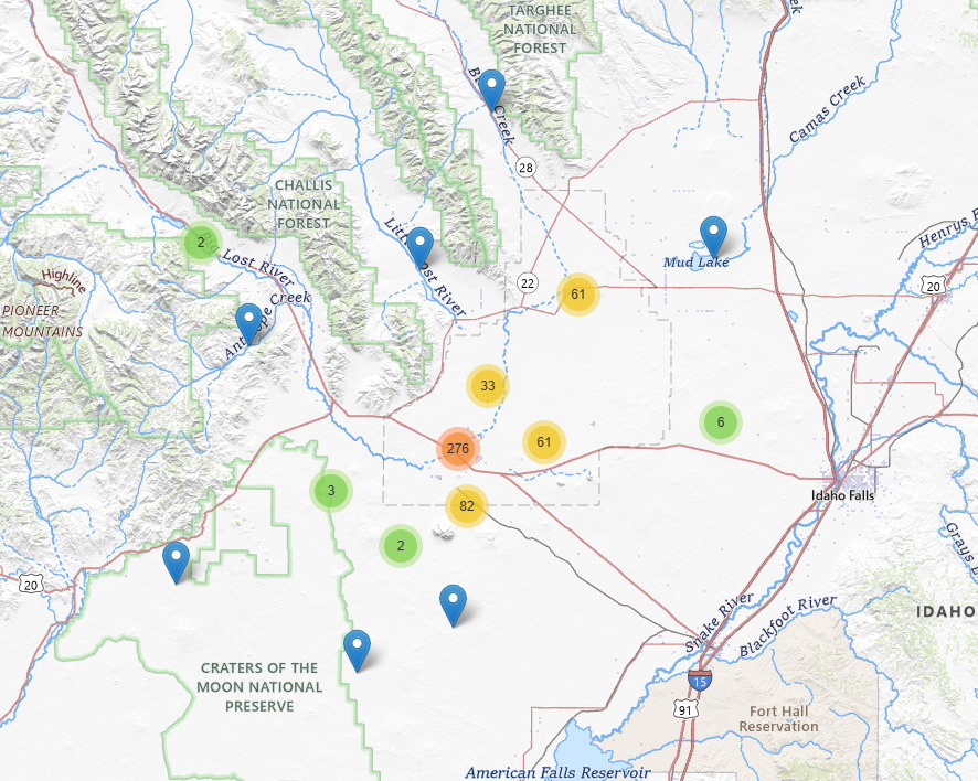
Map showing the site locations within the U.S. Geological Survey monitoring networks at the Idaho National Laboratory and surrounding areas, Idaho, from 1922 to 2024. The networks comprise 533 sites in total: 491 wells in the aquifer monitoring network, 30 wells in the perched-groundwater monitoring network, and 12 stream or lake sites in the surface-water monitoring network. Clustered marker locations are used in areas with a high density of sites for better visualization, with each cluster circle symbol indicating the number of sites it contains.
Sources/Usage
Public Domain.
Related
INLPO Monitoring Networks
The INLPO Monitoring Networks are essential for understanding the dynamics of groundwater and surface water, facilitating effective management of water resources within the eastern Snake River Plain aquifer system. These networks consist of multiple components designed to monitor various aspects, such as water levels and quality, providing vital data for environmental assessments and informed...