
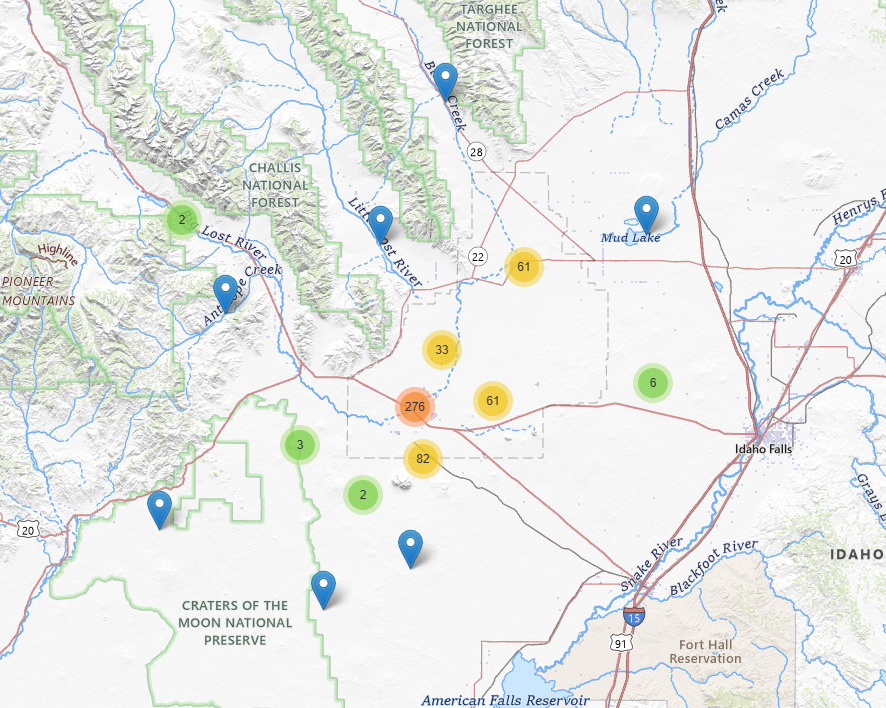
The INLPO Monitoring Networks are essential for understanding the dynamics of groundwater and surface water, facilitating effective management of water resources within the eastern Snake River Plain aquifer system. These networks consist of multiple components designed to monitor various aspects, such as water levels and quality, providing vital data for environmental assessments and informed decision-making.
To enhance management decisions regarding the hydrologic monitoring network, the U.S. Geological Survey (USGS) has developed specialized tools and software tailored for the Idaho National Laboratory (INL). Key optimization studies (Fisher and others, 2021; Fisher, 2013) serve as foundational references for policy adjustments affecting the hydrologic monitoring network. Recommendations derived from these studies have informed revisions to the USGS monitoring framework, ensuring continuous improvement in monitoring practices.
This comprehensive strategy enables the INLPO Monitoring Networks to effectively respond to evolving conditions and management needs, thereby enhancing the reliability of both groundwater and surface water monitoring.
Monitoring Networks
The monitoring networks at INLPO include:
- Water-Level Monitoring Network: This network tracks fluctuations in groundwater levels across the eastern Snake River Plain aquifer. Utilizing a kriging-based genetic algorithm, it optimizes the locations of monitoring wells to ensure accurate and reliable data for assessing groundwater dynamics, resource availability, and the impact of various stressors.
- Water-Quality Monitoring Network: Focused on evaluating groundwater quality in terms of chemical and physical parameters, this network emphasizes the strategic placement of monitoring stations to maximize the detection of changes in water-quality or first arrival of contaminants, facilitating effective management of contaminants and environmental concerns.
- Surface-Water Monitoring Network: This network assesses surface water bodies throughout the region, collecting critical data on flow rates, water levels, and water-quality. Such information is essential for understanding the interactions between surface water and groundwater and for comprehensive water resource management.
- Perched Groundwater Monitoring Network: Specializing in monitoring perched aquifers—groundwater zones that exist above the main aquifer layer—this network provides insights into localized water movement and conditions, ensuring that management strategies effectively address all groundwater resources.
- Multi-Level Monitoring Network: This network features wells equipped with multiple monitoring points at various depths, enabling a detailed understanding of groundwater conditions across different strata. This layered approach offers a nuanced perspective on groundwater behavior and its interactions with surrounding environments.