
insta_IreneOverview.png
Detailed Description
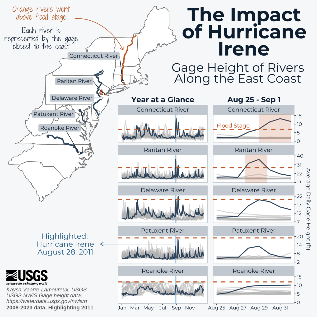
The impact of Hurricane Irene shown through gage height measured on rivers along the East Coast. A map shows the locations of the Connecticut, Raritan, Delaware, Patuxent, and Roanoke Rivers along the east coast. For each river, gage height measurements during 2011 are shown for the streamgage closest to the coast. The landfall of Hurricane Irene is highlighted, showing that gage height peaked when the storm arrived. Zoomed in charts show gage height from Aug 25- Sept 1 of 2011, with each location peaking near the end of Aug. The Connecticut and Raritan rivers exceeded flood stage and are highlighted in orange.
Sources/Usage
Public Domain.