
Inverted topography in the Clear Lake Volcanic Field
Detailed Description
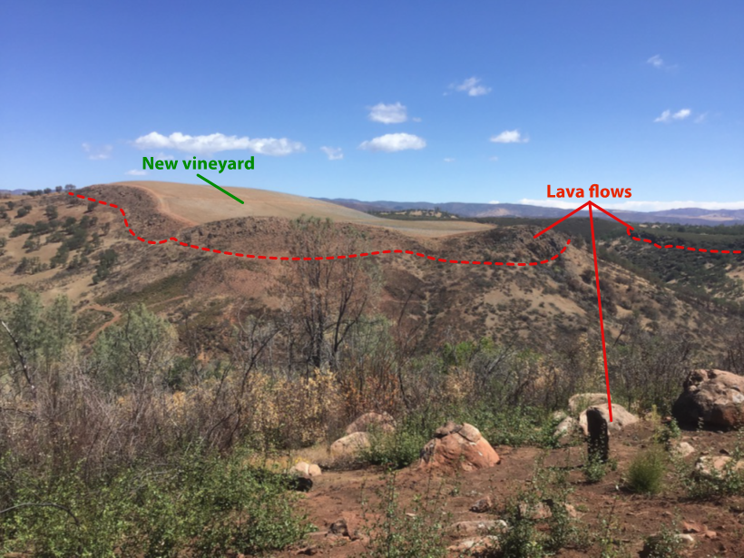
From this vantage point, the remnants of a Clear Lake volcanic field lava flow can be seen forming the prominent ridge across Highway 20. They are iron-rich and a popular location for vineyard cultivation. This lava flow is part of the oldest groups of rocks in the volcanic field, which erupted between 1 and 2 million years ago and can be found primarily as ridge-capping remnants scattered southeast toward lake Berryessa. When these flows erupted as molten rock, they flowed down the valleys and topographic low points present at the time. After they cooled and crystallized, they became more resistant to the erosive power of wind, rain, and gravity than the rocks around them. Over time, erosion “inverted” the topography, carving down through the softer rocks but not through the resistant lavas. The result of this process are lavas that were once in the valleys are now sitting atop ridges. This inverted topography is spectacular present-day evidence of how extensively erosion can modify a landscape on the million-year timescale as illustrated in the diagram. USGS photo by Dawnika Blatter, modified by Seth Burgess.
Sources/Usage
Public Domain.