
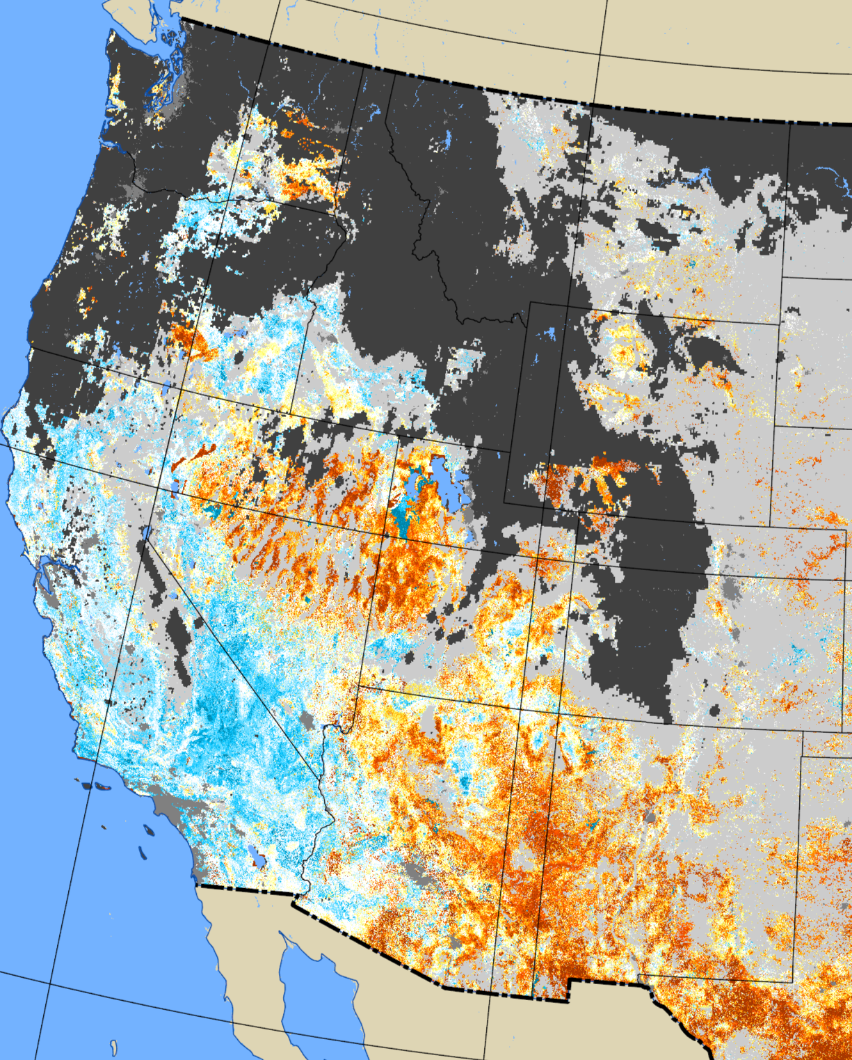
January 11, 2026, QuickDRI map of the western United States.
Detailed Description
The January 11, 2026, QuickDRI map of the western United States. Greens to blues = wetter conditions, orange to reds = drier, white to pale yellow = near average, periwinkle = water, light gray = off season, medium gray = urban areas, and dark gray/black = no data
Sources/Usage
Public Domain.