
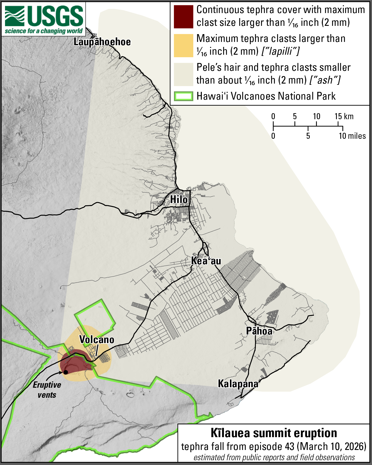
March 12, 2026—Summary map of tephra fall after episode 43 lava fountaining at the summit of Kīlauea

Detailed Description
This map shows the tephra fall associated with episode 43 of Kīlauea's episodic summit eruption, on March 10, 2026. Tephra is a generic word for any material erupted by a volcano that travels through the air before landing on the ground. Most tephra fall from past lava fountaining episodes has landed in the closed area of Hawaiʻi Volcanoes National Park, southwest of the eruptive vents, with several instances of tephra fall documented at communities in the District of Kaʻū. During episode 43 on March 10, lava fountains from the north and south vents in Halemaʻumaʻu at the summit of Kīlauea reached up at 540 m (1770 feet). Southwesterly winds blowing to the northeast resulted in widespread tephra fall in communities to the northeast and east within the Districts of Kaʻū, Puna, South Hilo, and North Hilo.
Sources/Usage
Public Domain.