
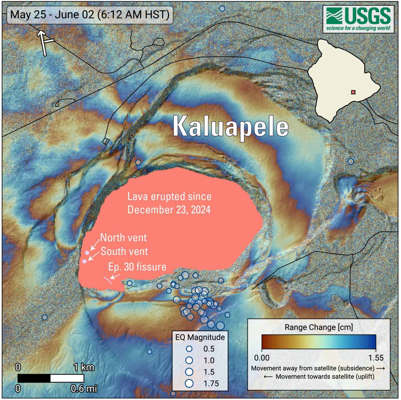
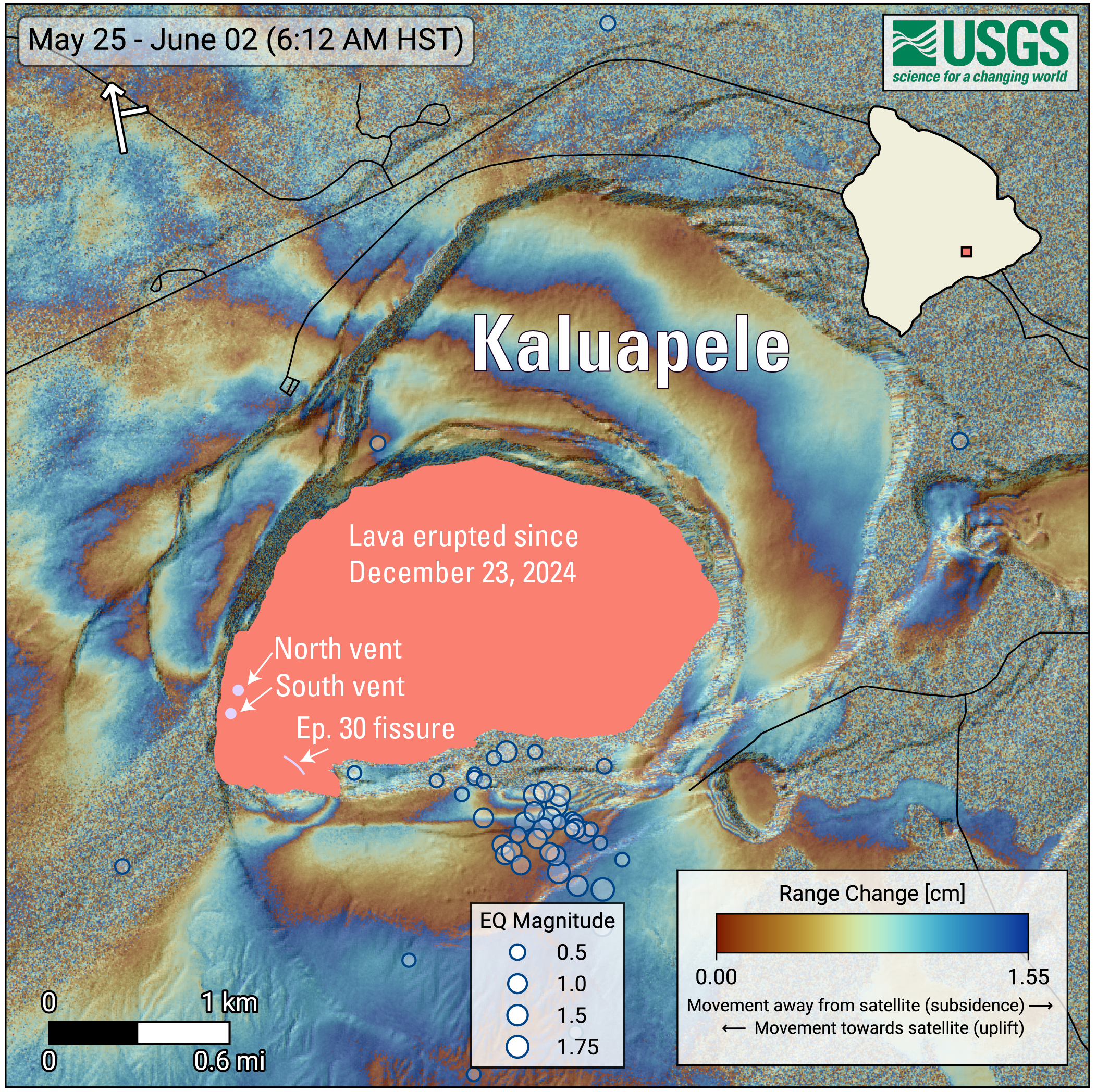
June 2, 2026—InSAR image of Kīlauea deformation associated with episode 48 of ongoing summit eruption
Detailed Description
COSMO-SkyMed Second Generation (CSG) interferogram for the period from May 25 to June 2, 2026, covering Kīlauea volcano’s summit region. Each color fringe represents 1.55 centimeters (0.61 inches) of ground movement in the direction between the satellite and the ground (range change). The symbol in the upper left indicates the satellite's orbit direction (arrow) and look direction (bar). Earthquakes are marked with circles with the size proportional to their magnitude. The lava flows covering the crater floor are represented by the pink polygon, the two vents (circles) and the Episode 30 fissure (line) are marked in light pink.
As episode 48 of lava fountaining in Halemaʻumaʻu at Kīlauea summit was ending on June 1, 2026, 53 earthquakes, most smaller than magnitude-2, occurred at depths up to 1 mile (1.5 km) below the ground surface beneath the south rim of Halema'uma'u crater. An area along the south rim of Halemaʻumaʻu also rose by several inches (centimeters). The specific cause of that uplift remains uncertain but it could be related to magma movement.
Sources/Usage
Public Domain.
Related

Eruption Information
Related